See more on our Facebook page:

Thursday, April 6, 2017

Eastern Panhandle Watershed Spring Gathering


2017 Eastern Panhandle
Watershed Group Gathering
23rd * May * 2017

Blue Ridge Community and Technical College
13650 Apple Harvest Drive
Martinsburg, WV 25403

Room 1101

Come network with other watershed professionals and volunteers, find out whats happening in the watersheds of the panhandle, and learn about new resources to improve your work!
 
When
9:00AM- 12:30PM
May 23, 2017
Where
Blue Ridge Community and Technical College
13650 Apple Harvest Drive
Martinsburg, WV 25403

Room 1101
  
  
Morning refreshments will be provided! Lunch is on your own and available at the Bruin Café, located just downstairs from our event!

The Eastern Panhandle Conservation District (EPCD) would like to invite the public, particularly those active in watershed groups, or those interested in becoming active in a local watershed group to attend this Watershed Group Gathering. EPCD strives to continually provide new information and resources to their partners at every gathering. This meeting is intended to offer resources to watershed groups and to be an information exchange between participating government agencies, local watershed groups and other environmental non-profits. It is an opportunity for agency and watershed representatives to give updates on projects, activities, and programs that are available. This is a great opportunity to network and learn more about local watershed activities!

The agenda for the day will include:  
- Watershed Highlights (updates from watershed groups and partners)
- Watershed Speed Networking
- A panel on Source Water Protection Planning
- Follow The Money- Where our Funding Comes From  

For more information, please contact Suzy Campbell, WVCA Conservation Specialist, at (304) 539-2682 or scampbell@wvca.us

Sponsored By:
Eastern Panhandle Conservation District


Monday, March 27, 2017

Water Jobs - March 2017


Current Openings:


Stream Restoration Specialist, VA Department of Environmental Quality (#P4464) – Job Closing Date: March 31, 2017 – Richmond, VA --https://jobs.agencies.virginia.gov/applicants/jsp/shared/position/JobDetails_css.jsp?postingId=1167146

Stormwater Training Specialist, VA Department of Environmental Quality (#P0462) – Job Closing Date: March 31, 2017 – Richmond, VA --https://virginiajobs.peopleadmin.com/postings/69472

Environmental Engineer Senior, Virginia Department of Health (04555) – Closing Date: March 31, 2017 – Abingdon, VA -- https://virginiajobs.peopleadmin.com/postings/search?utf8=%E2%9C%93&query=&query_v0_posted_at_date=&628%5B%5D=129&693%5B%5D=55&627=&696=&commit=Search

Environmental Protection Specialist, DC Department of Energy and Environment (JO-1703-8181) -- Job Closing Date: April 5, 2017 --http://careers.dc.gov/ts2__JobDetails?jobId=a0K1600000kAh8DEAS&tSource=

Water Withdrawal Permit Writer, VA Department of Environmental Quality (P4333 & P4492) – Closing Date:  April 7, 2017 – Richmond, VA --http://www.deq.virginia.gov/AboutUs/Employment/DEQJobs.aspx


Chesapeake Conservation Corps Member – Applications due: April 14, 2017 (5pm) – Multiple Host Sites Throughout the Chesapeake Bay Watershed --https://cbtrust.org/prospective/

Communications Intern, The Alliance for the Chesapeake Bay – Applications Due: April 14, 2017 – Annapolis, MD -- http://www.chesapeakebay.net/jobs

Environmental Health Director - Office of Drinking Water, Virginia Department of Health (03976) -- Open Until Filled -- Richmond, VA --https://virginiajobs.peopleadmin.com/postings/70705

Communications & Outreach Associate, Potomac Riverkeeper Network – Washington, DC -- http://www.potomacriverkeepernetwork.org/careers/

Tuesday, March 14, 2017

From the Fast Company Blog


Replacing Farms With Fish Farms: The Odd Solution To Both Hunger And Climate Change

Imagine a world where polluting, resource-intensive cow, pig, and chicken farms are replaced with giant tanks of fast-growing salmon. It might be a strange view of agriculture, but a potential huge shift in how we feed the planet.


By Ben Paynter


It may be the dead of winter, and the nation’s capital city may not be coastal, but this month marks the start of a distinct version of salmon season in and around Washington, D.C. Restaurants ranging from the iconic Chart House in Alexandria and Annapolis to all seven of critically acclaimed Top Chef contestant Bryan Voltaggio’s eateries will be offering preparations of a different kind of locally sourced fish on their menus.


The catch: All of these fish will be coming from 70 miles inland of the capital, from a company called Spring Hill. The fish will be harvested from a land-based “recirculating aquaculture system,” the industry term for a gigantic eco-friendly, land-based fish tank located at the Conservation Fund’s Freshwater Institute in Shepherdstown, West Virginia.

The Fish Farm Of The Future

The Institute is housed in a large warehouse surrounded by fields and pastures along an otherwise rural road. It holds a 40,000-gallon circular fish tank that resembles a large above-ground swimming pool with portholes. Beside it are several large water filtering towers, which are designed to strip out residual waste like leftover food and fish poop to be treated and broken down into nitrogen and phosphorous-rich fertilizer that settles in compost bins outside the building. Ninety-nine percent of

from the Society for Freshwater Science


USGS releases an open-source digital reference collection for aquatic macroinvertebrate of North America
https://sciencebase.usgs.gov/naamdrc/

Thursday, February 9, 2017

Blandy Farm: Deer-Resistance Plants

Remember, no one has told the deer about this list, and the deer typically try something before they decide they no longer want to eat it. They also don't report their experience on Yelp, so every deer may want to try your deer-resistant plant, and maybe once a year. Expect damage.


White-tailed deer are responsible for a great deal of landscape destruction.  Using landscape plants NOT preferred by deer is one way to prevent or at least lessen damage.  The plants deer prefer to eat vary from region to region and change seasonally.  No plant is completely deer proof.  
www.blandy.virginia.edu

Tuesday, January 10, 2017

Job Opening - Pocahontas Co.

JOB ANNOUNCEMENT:  POCAHONTAS COUNTY WATER RESOURCES COORDINATOR

        
The Pocahontas County Water Resources Task Force and the Pocahontas County Commission seeks an organized, self-motivated individual to manage, create programs, continue implementation efforts, and monitor the Pocahontas County Water Resources Management Plan as their new Pocahontas County Water Resources Coordinator.
        
Pocahontas County is the first West Virginia county to create a county-wide Water Resources Management Plan.  Our plan is complete and implementation has been underway during the past two years, but there is more to do.
        
The Pocahontas Water Resources Task Force, a community volunteer group, and the Pocahontas County Commission, are looking for a self-starter candidate with a true passion for water to continue our work.  Please note that this position is NOT an advocacy position.  We focus on our common reliance on water and work to ensure all voices are heard and all viewpoints of the county are represented.

JOB RESPONSIBILITIES:
  • Public speaking for outreach and education to different county audiences
  • Regular reports to County Commission
  • Organizing and conducting meetings of the Task Force
  • Writing grants for new programs and submitting grant reports
  • Water monitoring – using GIS, taking samples, operating laboratory equipment, and performing water quality analysis

QUALIFICATIONS:
  • Bachelor’s degree with experience in any discipline related to agriculture, biology, geology, forestry, environmental science, wildlife, fisheries, chemistry, geography, or commensurate work experience in

Thursday, December 29, 2016

Urban Forestry Webinar, January 11, 1pm


Integrating Experts, Communities, and Online Resources for Equitably Expanding Urban Tree Canopy
Wednesday, January 11, 2016 | 1:00 - 2:15pm ET
The availability of online mapping resources and "big data" on cities offers an approach to address challenges in inequitable distribution of urban tree canopy, as well as waning community engagement in tree canopy management and expansion. One of the biggest impediments to executing an effective urban forestry management plan is the integration of expert systems, such as data resources and analytics, with community-led efforts. Using the case of Portland, Oregon, this webinar will provide context for assembling city-scale programs that enable community groups, researchers, and city staff to advance urban canopy management and expansion.
Angie DiSalvo will present the context for the City of Portland's urban canopy management, including a description of the structure and findings from a volunteer tree inventory, policy changes, and the challenges and opportunities for urban canopy stewardship. 
Vivek Shandas will then share an overview of the expert data systems that support the expansion of tree canopy and availability of online resources that support community activism. Together they will describe an emerging partnership between city and university that

Saturday, November 26, 2016

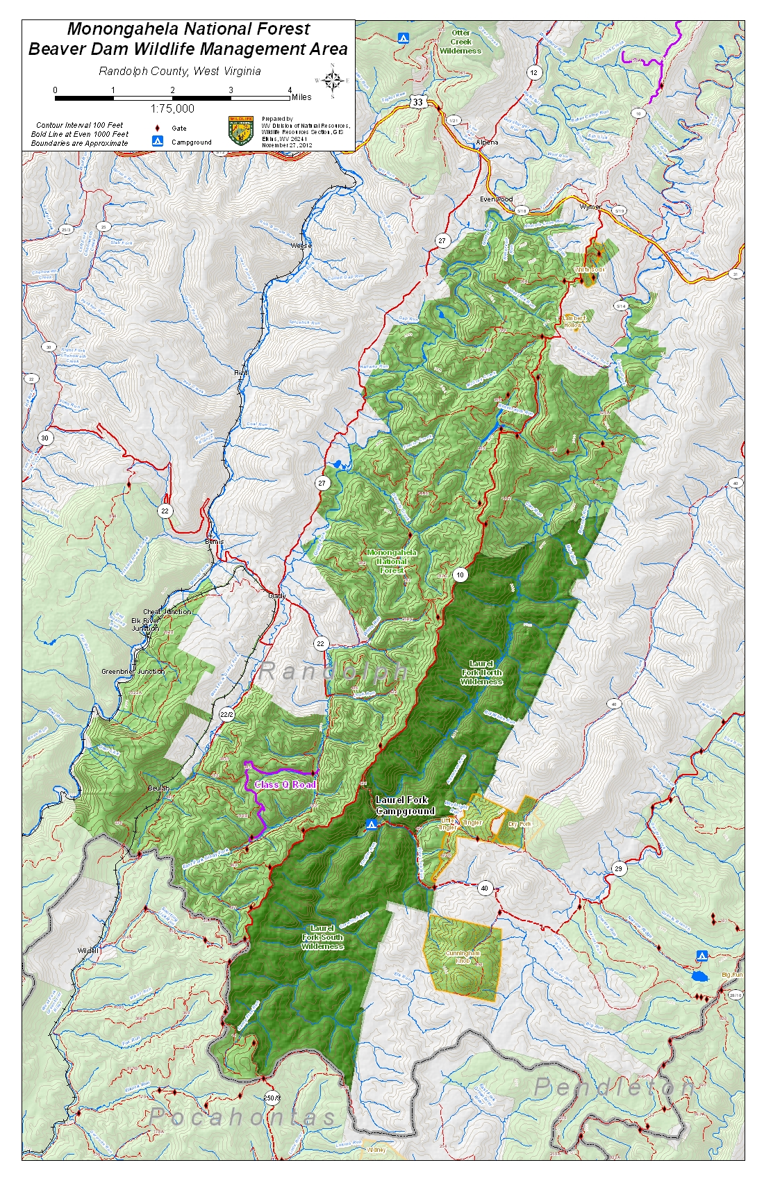
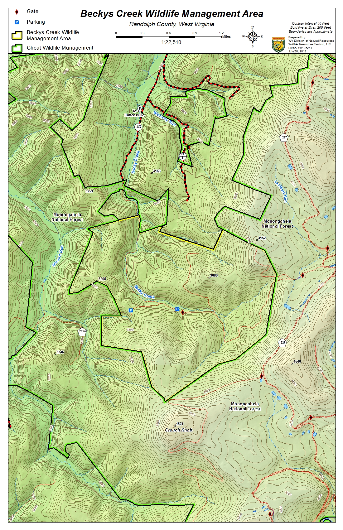
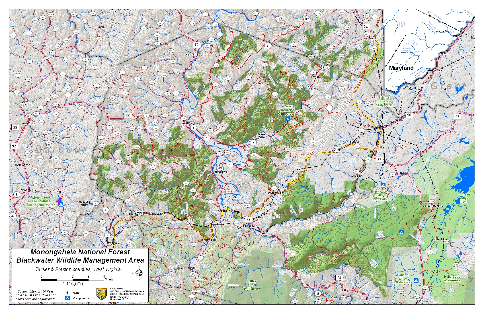
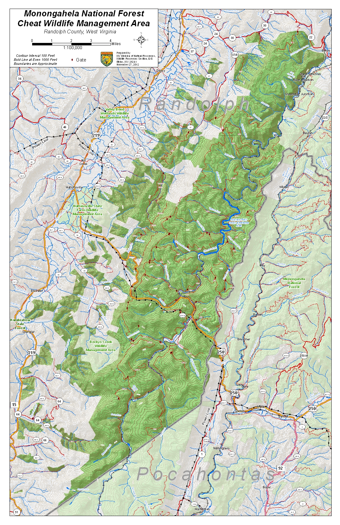
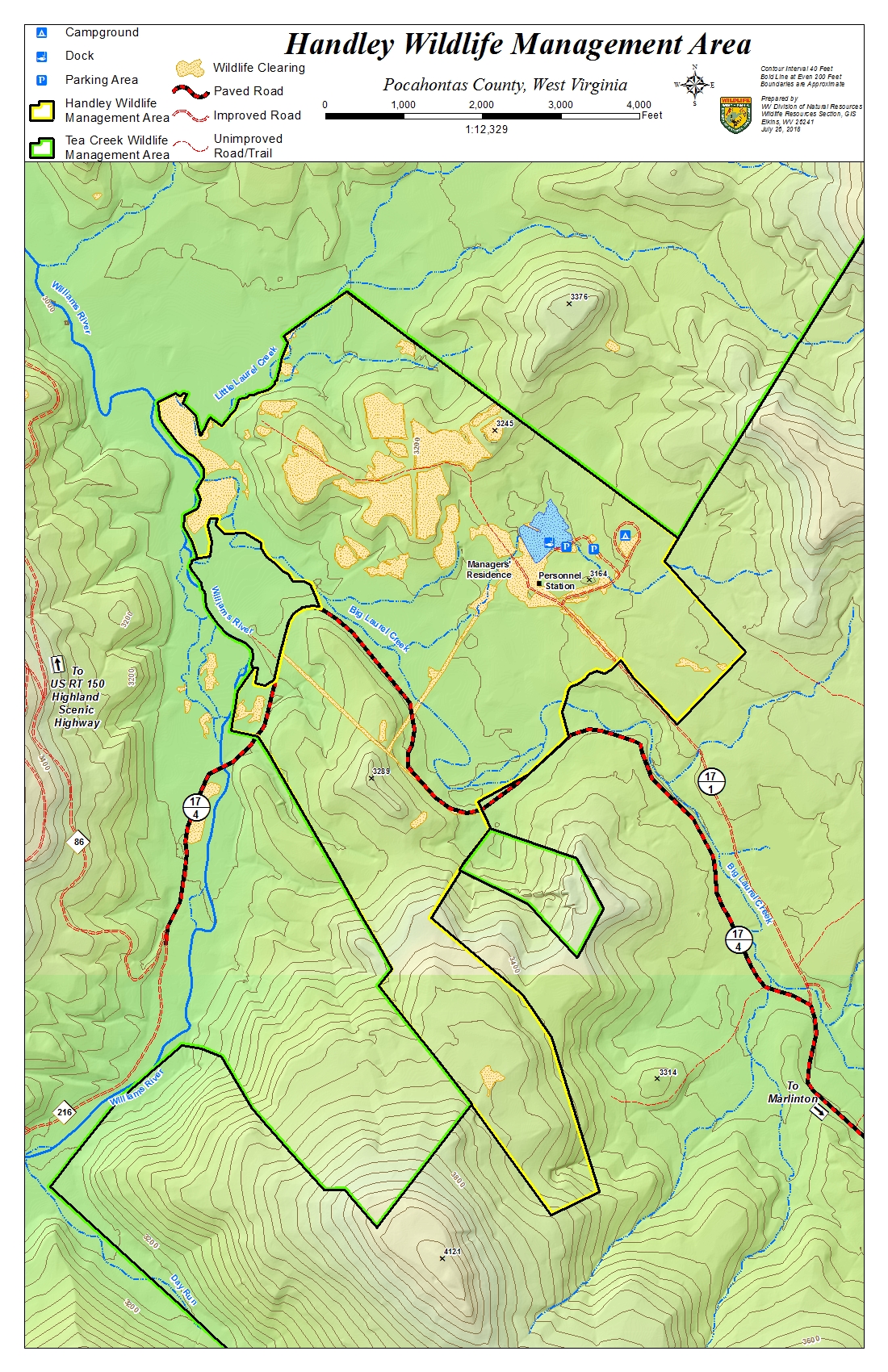
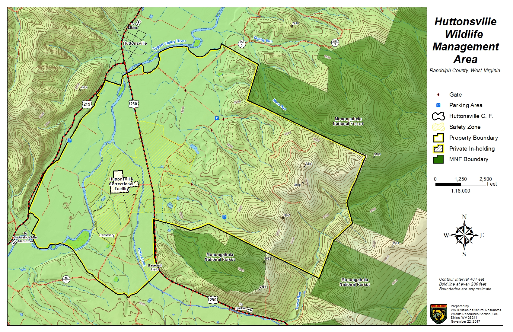
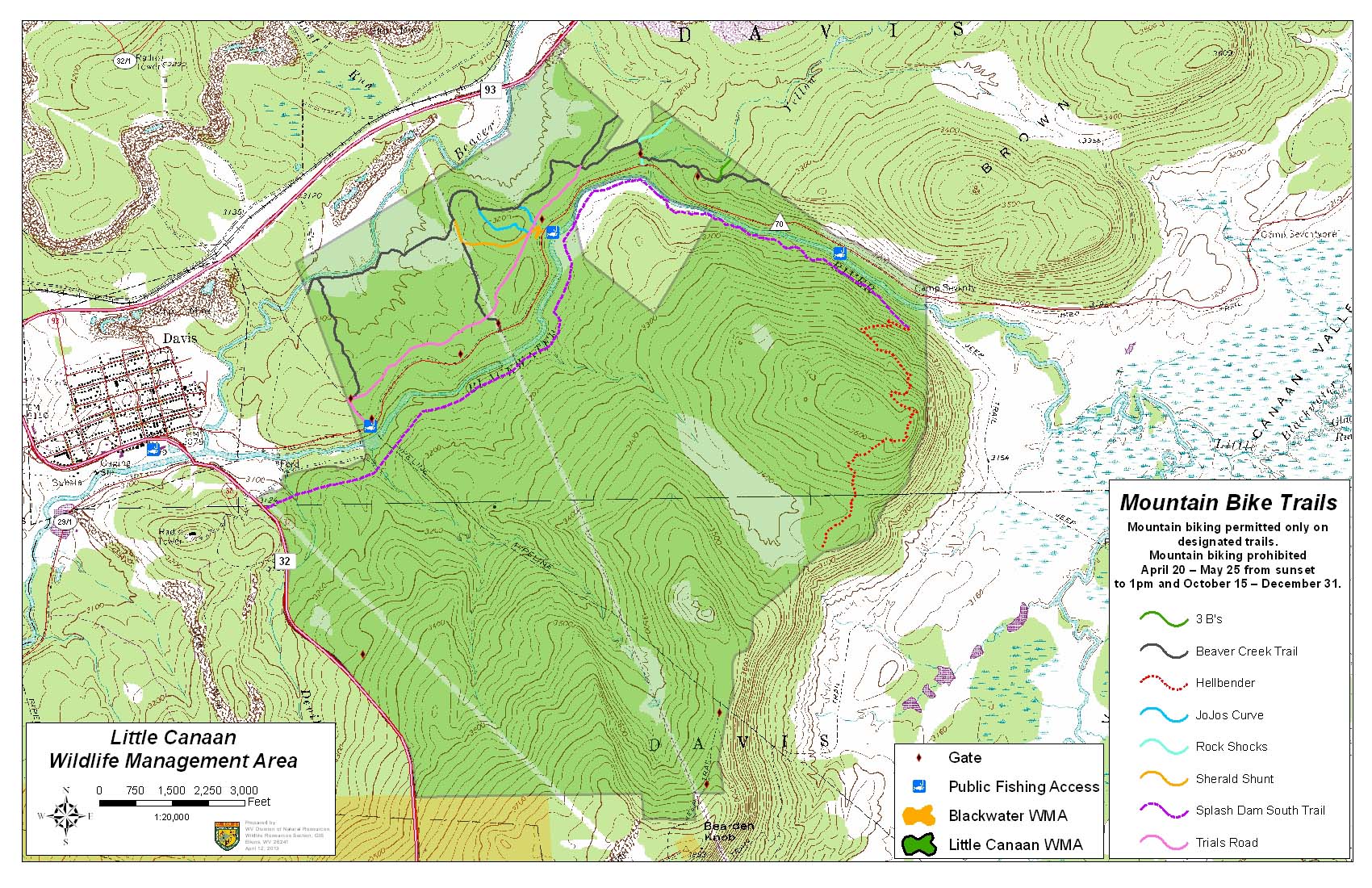
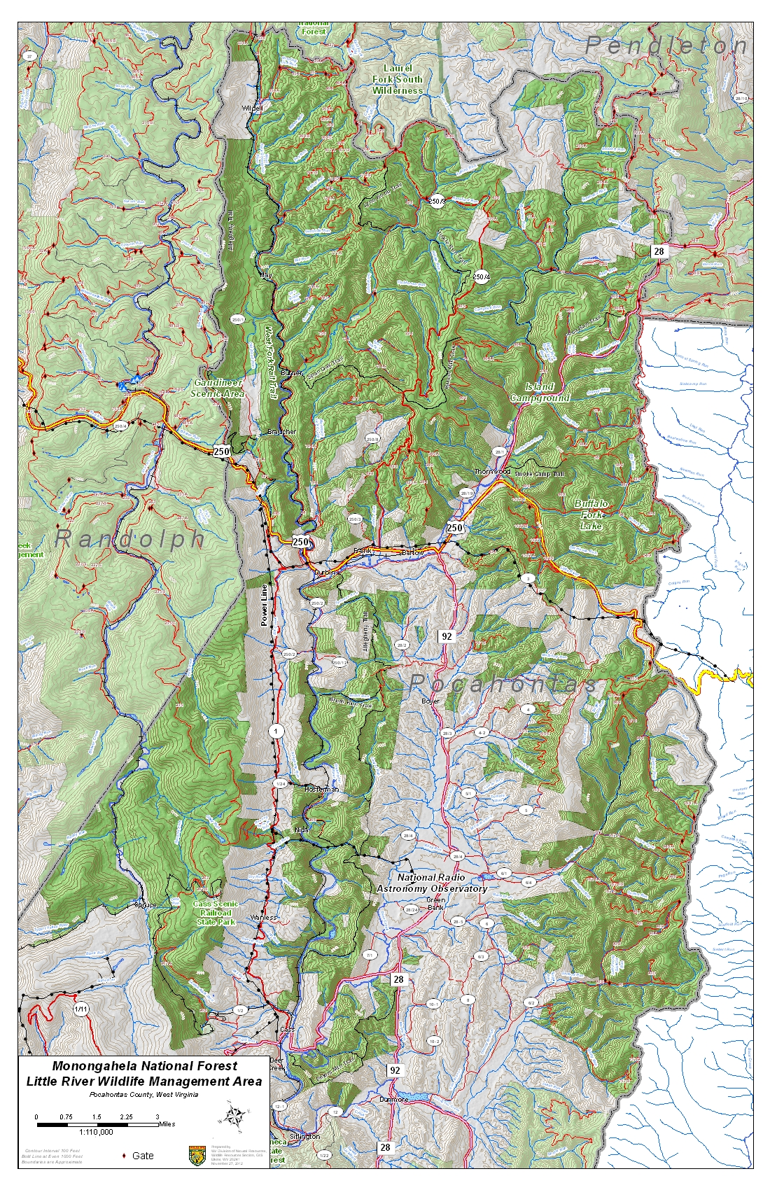
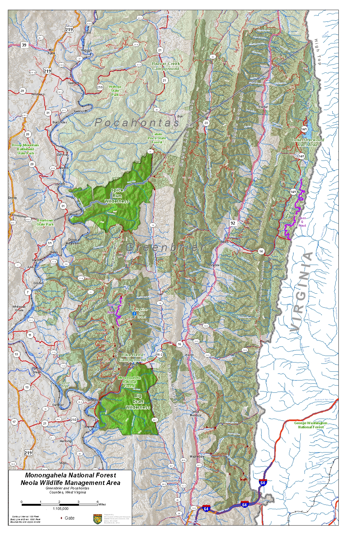
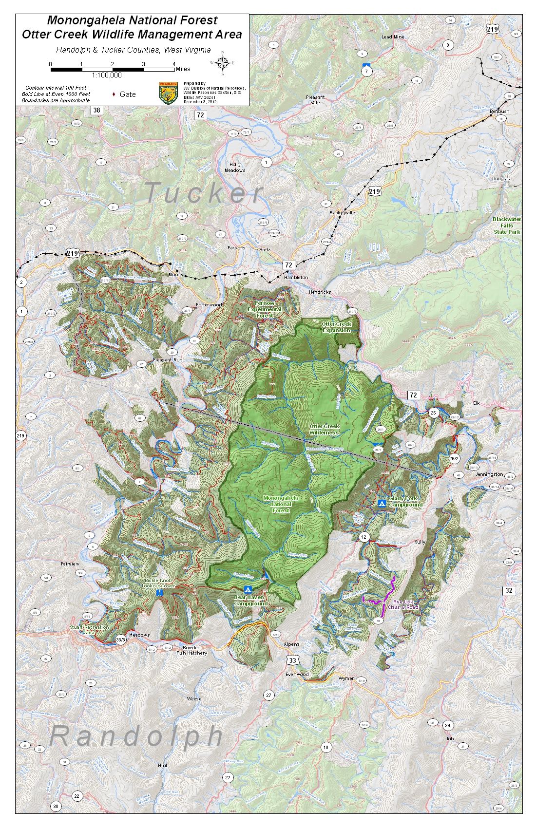
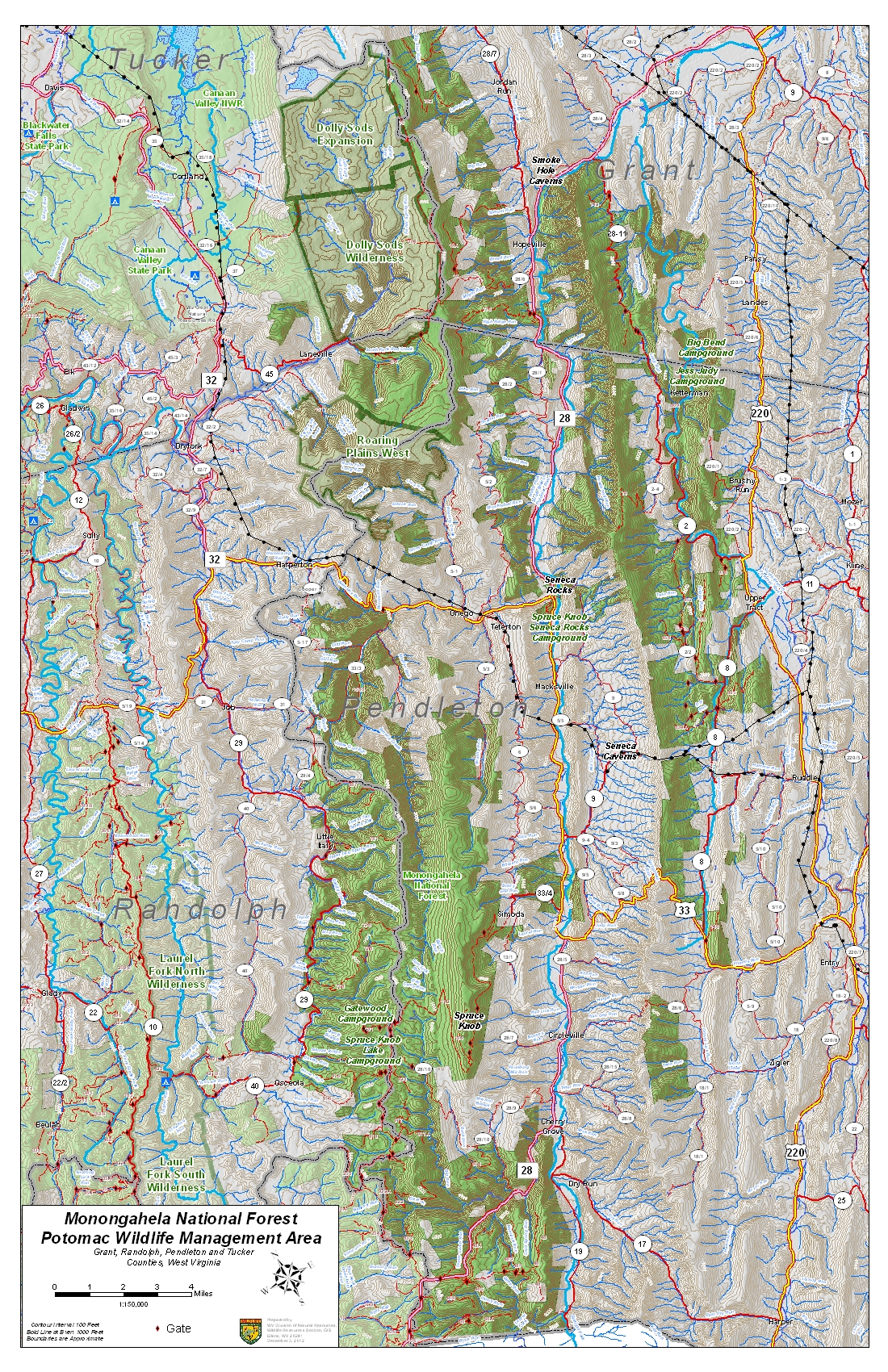
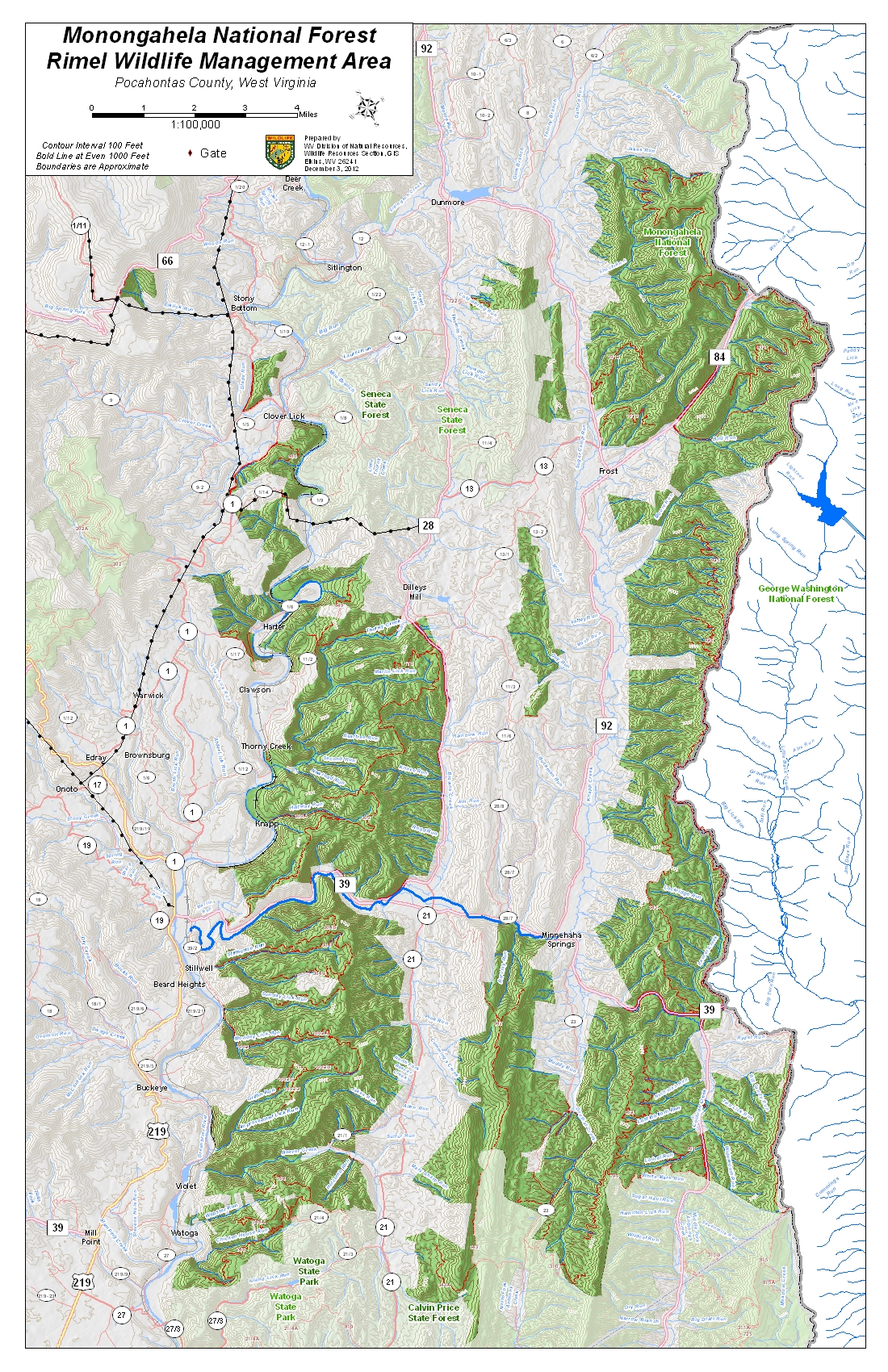
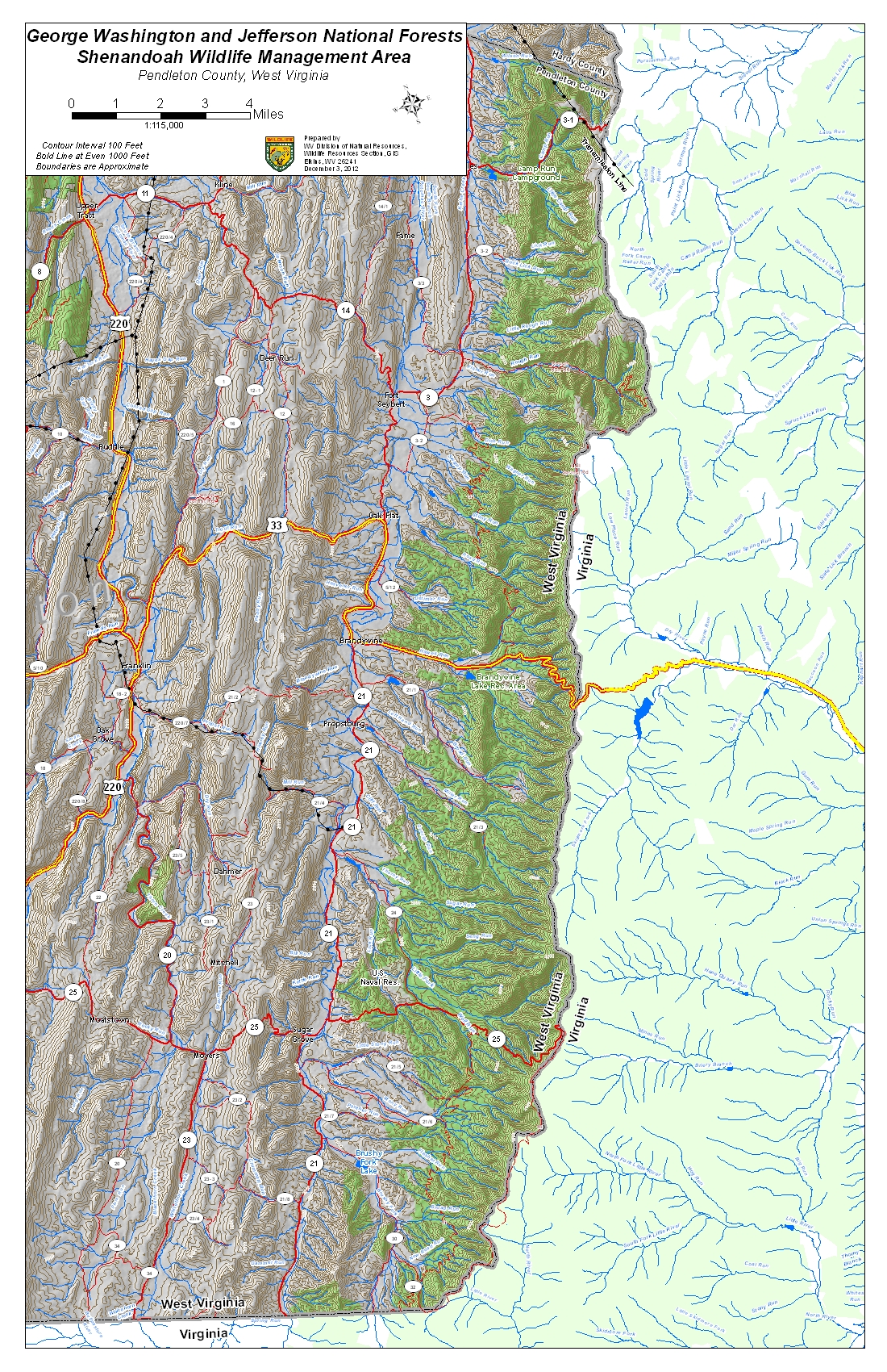
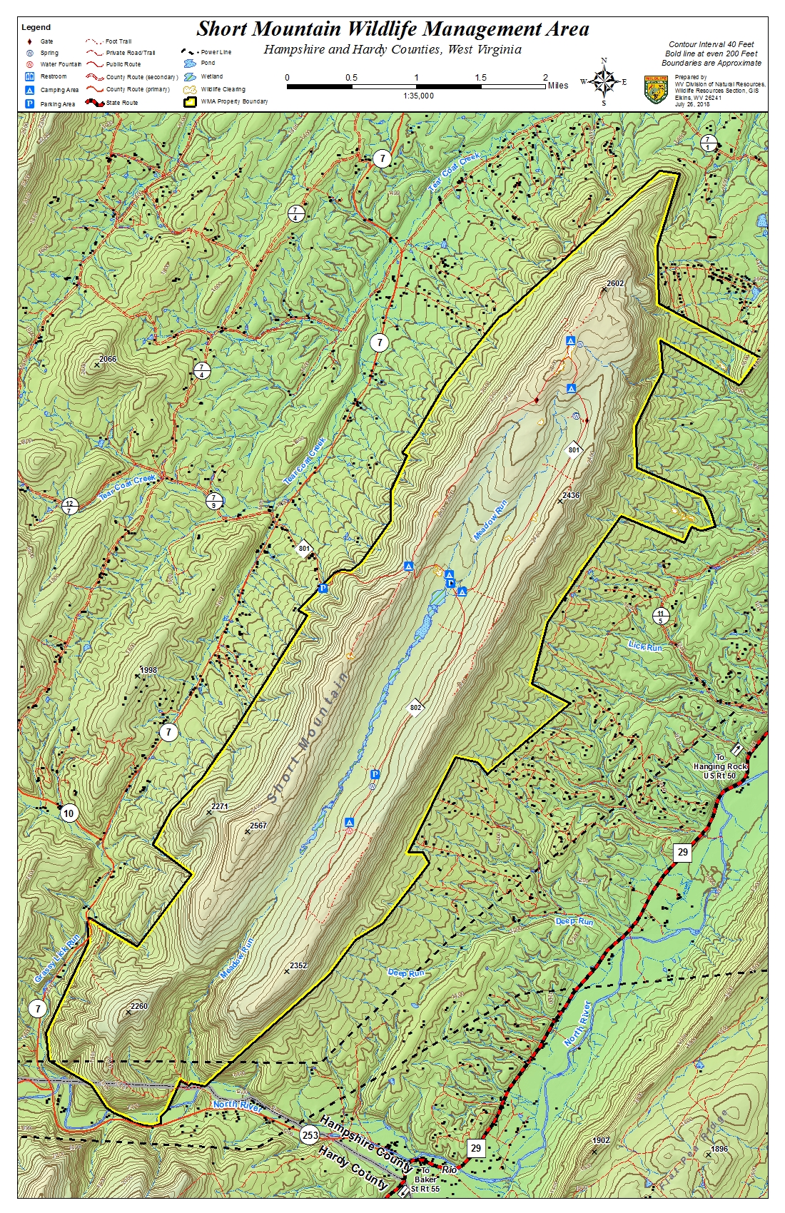
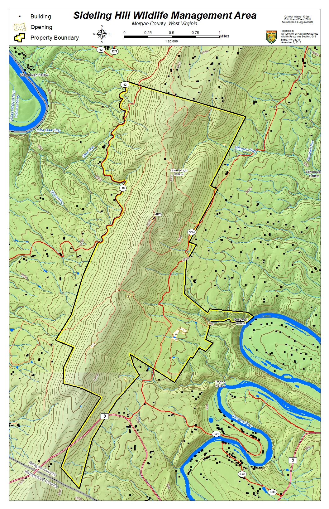
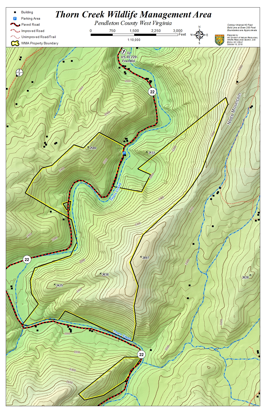
Wildlife Management Areas of the Upper Potomac and nearby West Virginia highlands.

http://southbranchpotomac.blogspot.com/p/south-branch-topo-maps.html

Upper Potomac and other nearby WMA Topo Maps


Provided in a longer statewide list by WVDNR. The file sizes are shown for each map so that the viewer can select which file to download based on their computer equipment and the speed of their internet connection.
WMA NameHigh ResolutionMedium ResolutionLow ResolutionCounty
( 300 dpi PDF)( 150 dpi PDF)( JPEG )
Allegheny WMA Map( 37.7mb )( 10.9mb )( 2.2mb )Mineral


Beaver Dam WMA Map( 16.7mb )( 5.9mb )( 2.2mb )Randolph
Becky Creek WMA Map( 24.1mb )( 8.2mb )( 2.1mb )Randolph


Blackwater WMA Map( 17.1mb )( 6.8mb )( 2.5mb )Tucker & Preston


Cheat WMA Map( 17.9mb )( 6.6mb )( 2.4mb )Randolph


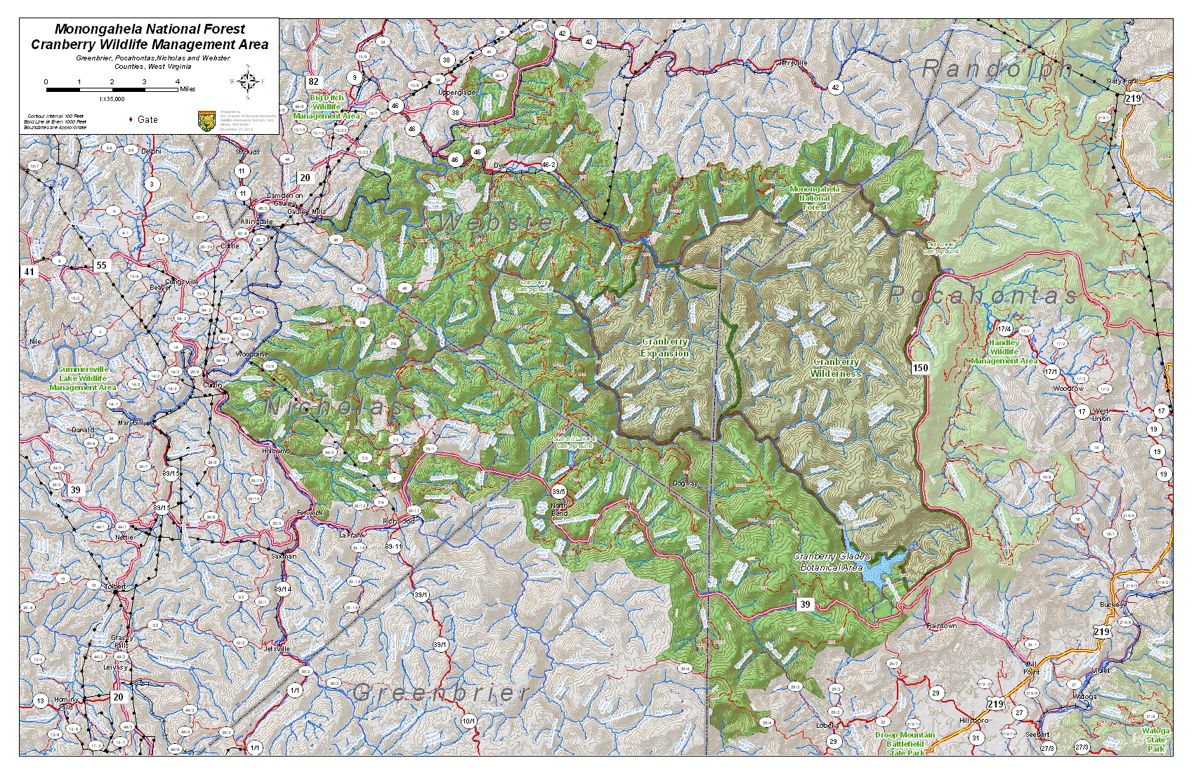
Cranberry WMA Map( 27.1mb )( 13.4mb )( 2.7mb )Greenbrier, Pocahontas, 


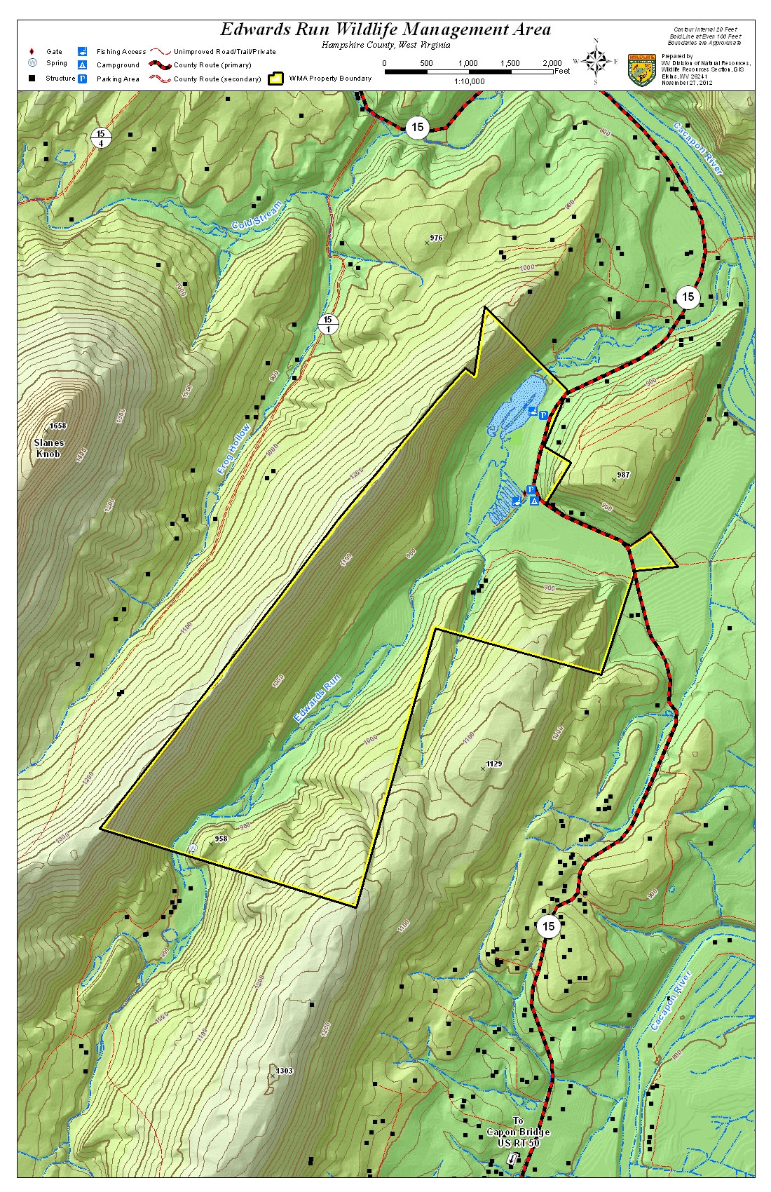
Edwards Run WMA Map( 17.1mb )( 5.8mb )( 2.0mb )Hampshire


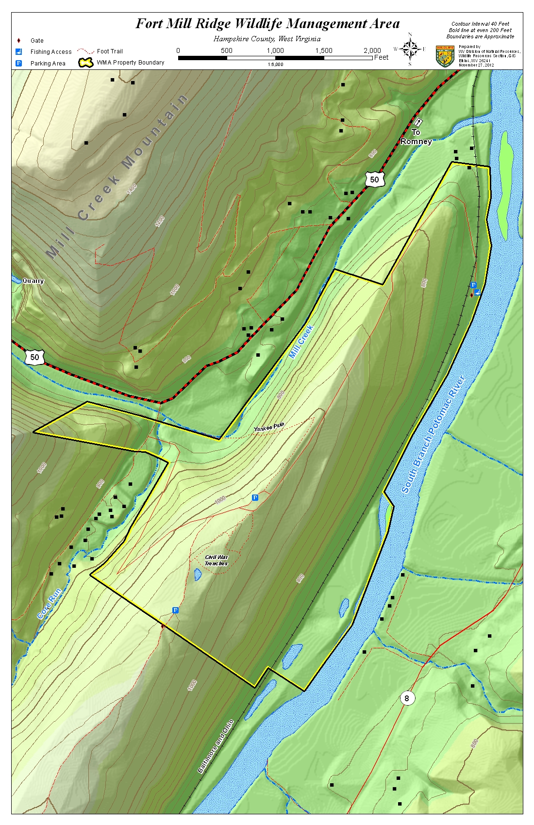
Fort Mill Ridge WMA Map( 10.5mb )( 3.9mb )( 1.5mb )Hampshire
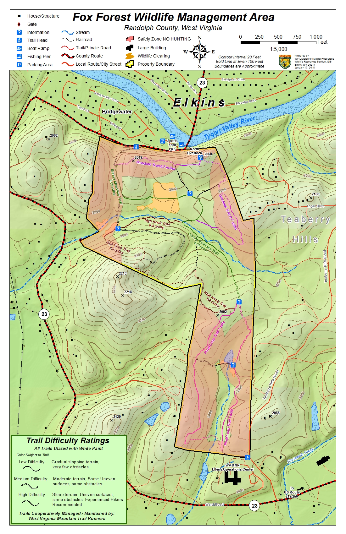
Fox Forest WMA Map(14.5mb )( 4.7mb )( 1.7mb )Randolph


Handley WMA Map( 2.8mb )( 1.8mb )( 1.7mb )Pocahontas


Huttonsville WMA Map( 23.1mb )( 2.0mb )Randolph


Little Canaan WMA Map( 1.7mb )( 0.7mb )( 0.8mb )Tucker & Preston


Little River WMA Map( 26.1mb )( 13.2mb )( 2.5mb )Pocahontas


Nathaniel Mountain WMA Map( 32.6mb )( 10.1mb )( 2.4mb )Hampshire & Hardy
Neola WMA Map( 25.5mb )( 13.9mb )( 2.5mb )Greenbrier & Pocahontas


Otter Creek WMA Map( 16.2mb )( 5.8mb )( 2.2mb )Randolph & Tucker


Potomac WMA Map( 48.3mb )( 33.5mb )( 2.7mb )Grant, Randolph, Pendleton


Rimel WMA Map( 15.6mb )( 5.4mb )( 2.1mb )Pocahontas


Shenandoah WMA Map( 13.8mb )( 5.9mb )( 2.2mb )Pendleton
Short Mountain WMA Map( 31.8mb )( 10.2mb )( 2.4mb )Hampshire & Hardy
Sideling Hill WMA Map( 1.7mb )( 1.0mb )( 1.9mb )Morgan
Slatyfork WMA Map( 14.6mb )( 4.9mb )( 1.8mb )
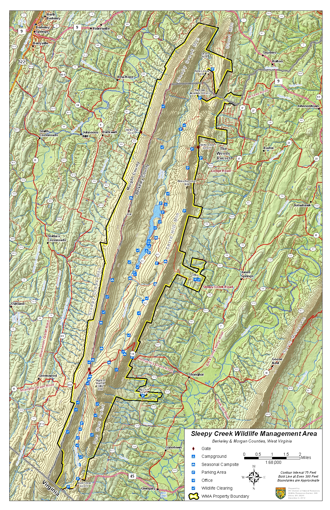
Sleepy Creek WMA Map( 43.2mb )( 18.7mb )( 2.6mb )Berkeley & Morgan


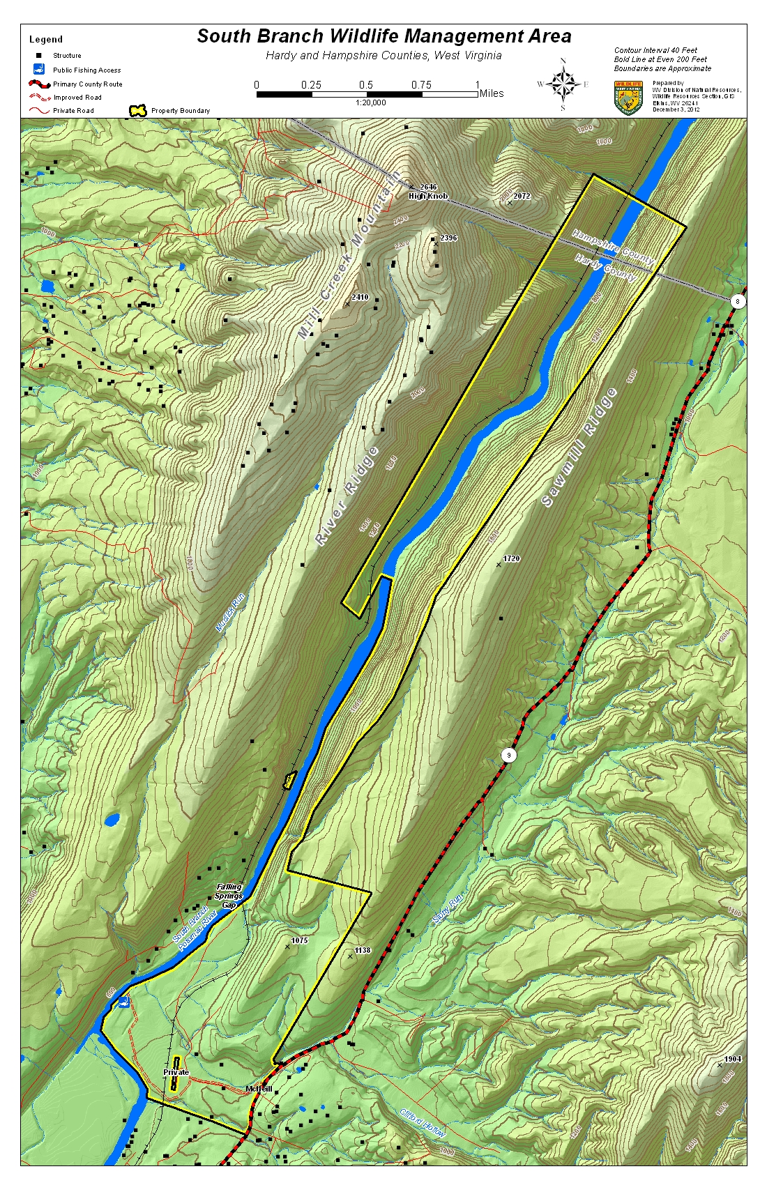
South Branch WMA Map( 22.1mb )( 7.8mb )( 2.1mb )Hardy & Hampshire


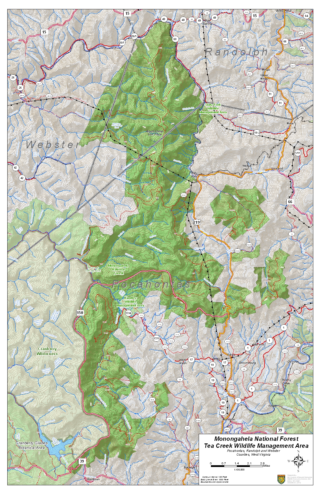
Tea Creek WMA Map( 20.0mb )( 8.5mb )( 2.5mb )Pocahontas, Randolph, & Webster


Thorn Creek WMA Map( 17.0mb )( 5.6mb )( 1.8mb )Pendleton


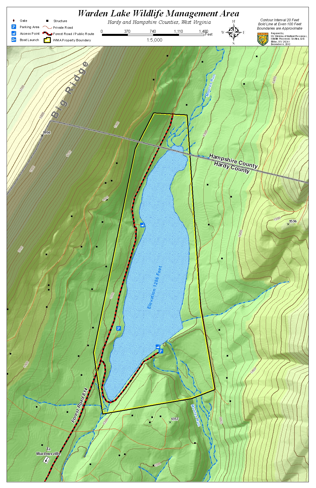
Warden Lake WMA Map( 9.7mb )( 3.4mb )( 1.6mb )Hardy & Hampshire
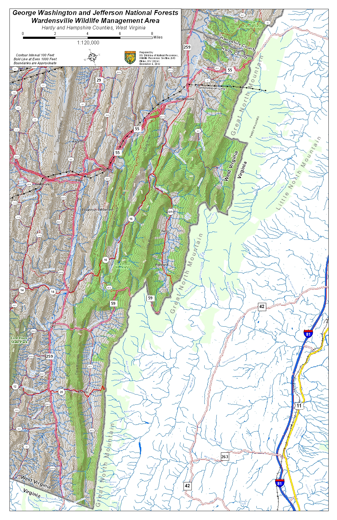
Wardensville WMA Map( 11.0mb )( 4.8mb )( 2.2mb )Hardy & Hampshire
Widmeyer WMA Map( 14.6mb )( 4.8mb )( 1.6mb )Morgan

Wednesday, September 14, 2016

Lowest River Levels

This is about as low as the South Branch gets in a typical summer.  Look for trapped minnows and mussels in small channels.  The tadpoles usually do just fine; unfortunately, the insects will also be fine.

South Branch Potomac River near Springfield

Thursday, June 30, 2016

WV Flooding Information

Flooding in West Virginia in June 2016 – Information Sources

by araflo
A line of thunderstorms on June 22-23, 2016, produced between 4 and 12 inches of rain in mountainous parts of eastern West Virginia and western Virginia, leading to devastating and fatal flooding in the Mountain State, as well as flooding in Virginia’s Alleghany Highlands.  A major federal disaster declaration for West Virginia was issued on June 25.  Following are several sources of information on the events.
Kevin Myatt, “Weather Journal” in The Roanoke TimesTrain of storms triggered epic W.Va. floodingRoanoke Times, 6/28/16; and Historic flooding in Alleghany Highlands, 6/24/16.
Charleston [W.Va.] Gazette-Mail, “2016 Flood,” online at http://www.wvgazettemail.com/news/2016floods.
West Virginia Division of Homeland Security and Emergency Management, online athttp://www.dhsem.wv.gov/Pages/default.aspx.
Federal Emergency Management Agency, “West Virginia Severe Storms, Flooding, Landslides, and Mudslides (DR-4273),” online at https://www.fema.gov/disaster/4273.