See more on our Facebook page:

Tuesday, January 10, 2017

Job Opening - Pocahontas Co.

JOB ANNOUNCEMENT:  POCAHONTAS COUNTY WATER RESOURCES COORDINATOR

        
The Pocahontas County Water Resources Task Force and the Pocahontas County Commission seeks an organized, self-motivated individual to manage, create programs, continue implementation efforts, and monitor the Pocahontas County Water Resources Management Plan as their new Pocahontas County Water Resources Coordinator.
        
Pocahontas County is the first West Virginia county to create a county-wide Water Resources Management Plan.  Our plan is complete and implementation has been underway during the past two years, but there is more to do.
        
The Pocahontas Water Resources Task Force, a community volunteer group, and the Pocahontas County Commission, are looking for a self-starter candidate with a true passion for water to continue our work.  Please note that this position is NOT an advocacy position.  We focus on our common reliance on water and work to ensure all voices are heard and all viewpoints of the county are represented.

JOB RESPONSIBILITIES:
  • Public speaking for outreach and education to different county audiences
  • Regular reports to County Commission
  • Organizing and conducting meetings of the Task Force
  • Writing grants for new programs and submitting grant reports
  • Water monitoring – using GIS, taking samples, operating laboratory equipment, and performing water quality analysis

QUALIFICATIONS:
  • Bachelor’s degree with experience in any discipline related to agriculture, biology, geology, forestry, environmental science, wildlife, fisheries, chemistry, geography, or commensurate work experience in

Thursday, December 29, 2016

Urban Forestry Webinar, January 11, 1pm


Integrating Experts, Communities, and Online Resources for Equitably Expanding Urban Tree Canopy
Wednesday, January 11, 2016 | 1:00 - 2:15pm ET
The availability of online mapping resources and "big data" on cities offers an approach to address challenges in inequitable distribution of urban tree canopy, as well as waning community engagement in tree canopy management and expansion. One of the biggest impediments to executing an effective urban forestry management plan is the integration of expert systems, such as data resources and analytics, with community-led efforts. Using the case of Portland, Oregon, this webinar will provide context for assembling city-scale programs that enable community groups, researchers, and city staff to advance urban canopy management and expansion.
Angie DiSalvo will present the context for the City of Portland's urban canopy management, including a description of the structure and findings from a volunteer tree inventory, policy changes, and the challenges and opportunities for urban canopy stewardship. 
Vivek Shandas will then share an overview of the expert data systems that support the expansion of tree canopy and availability of online resources that support community activism. Together they will describe an emerging partnership between city and university that

Saturday, November 26, 2016

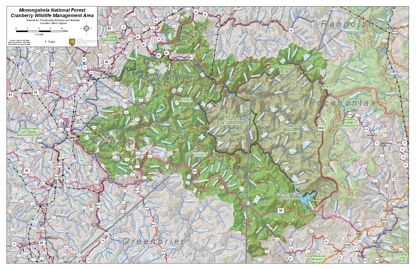
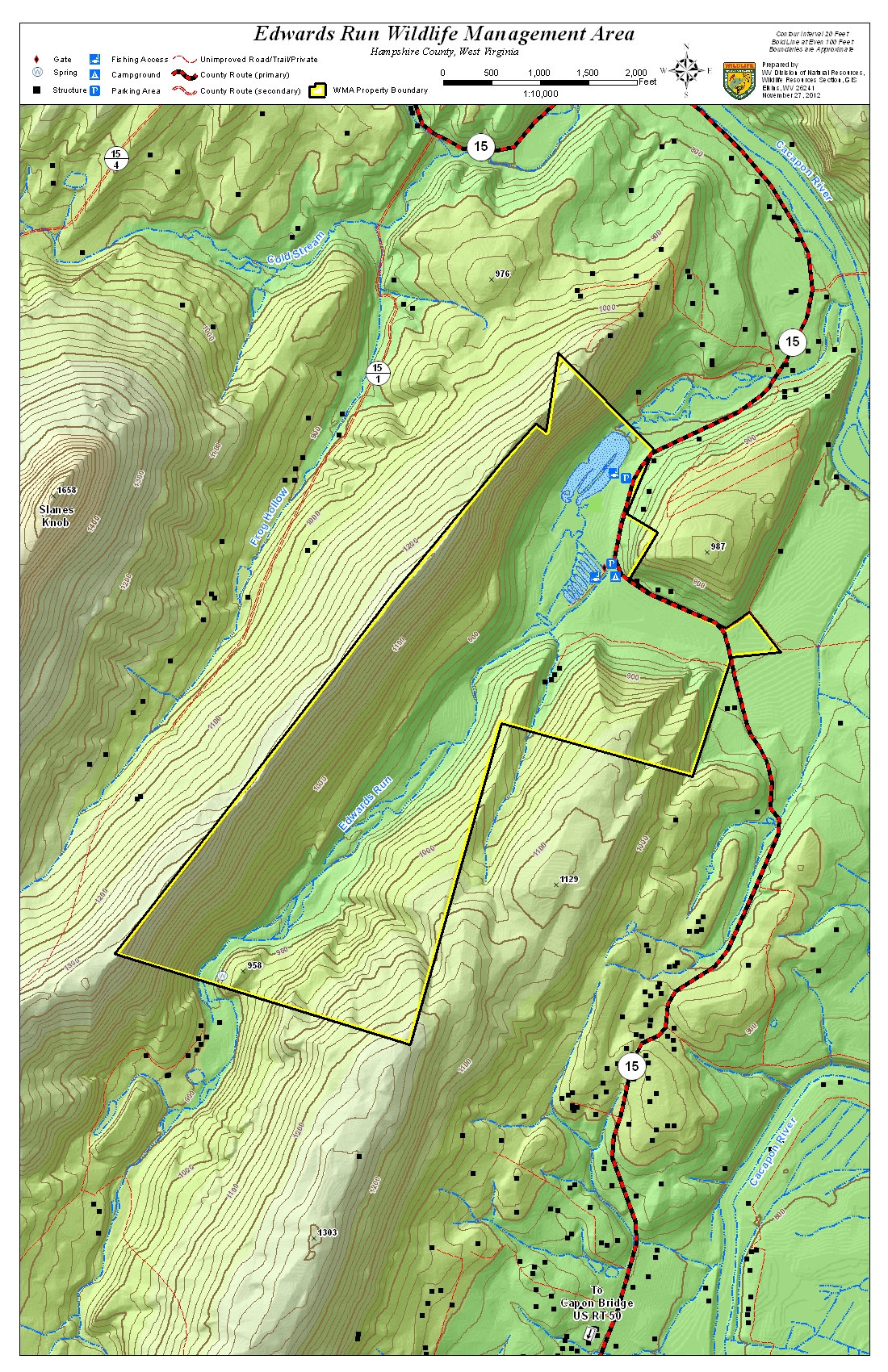
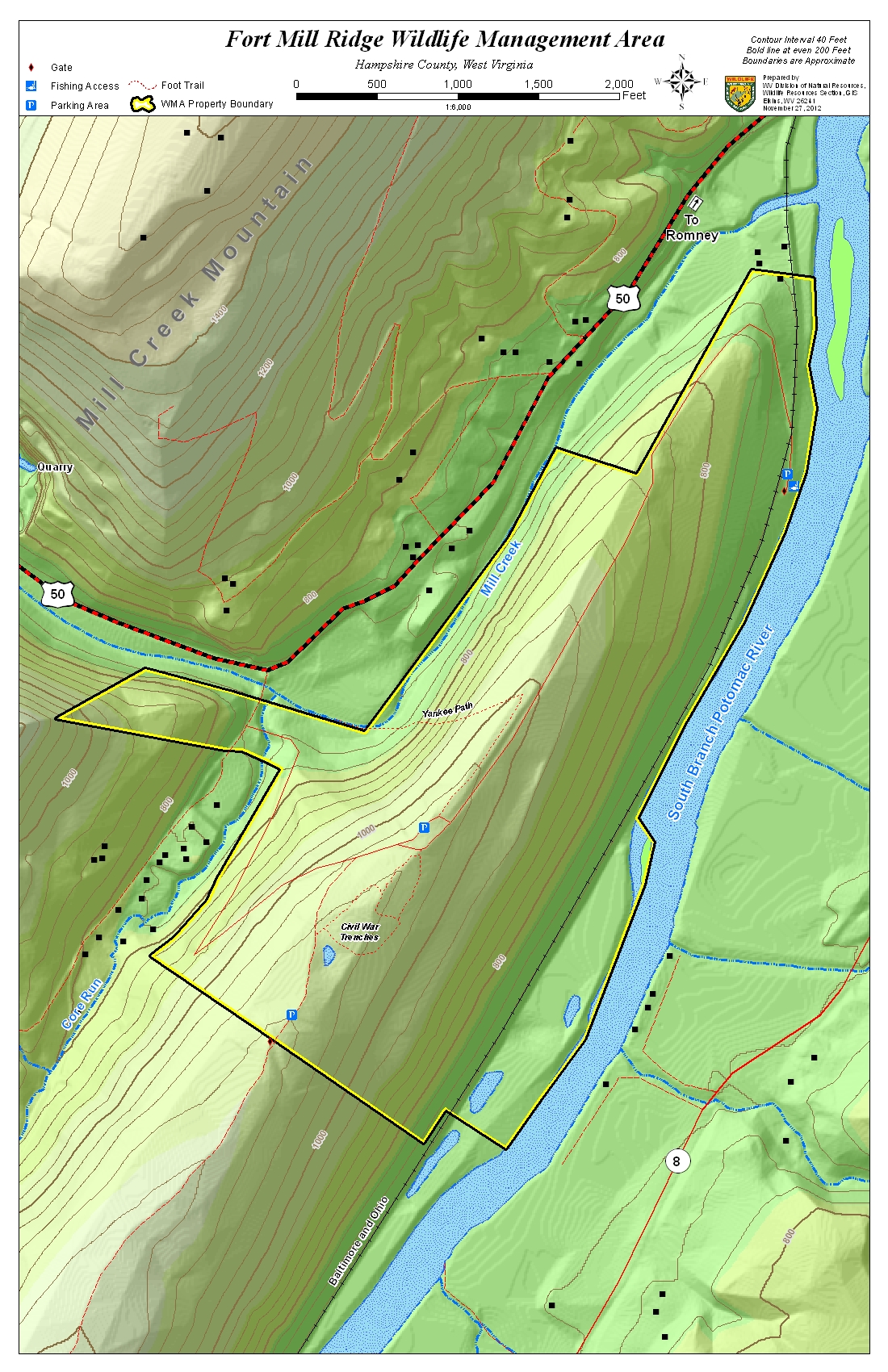
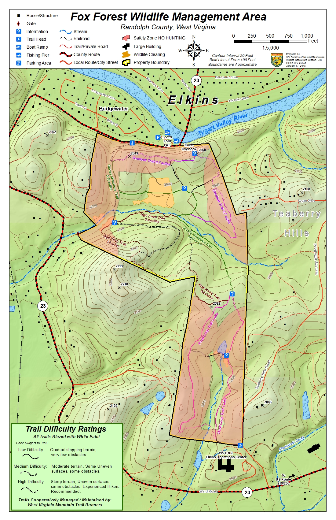
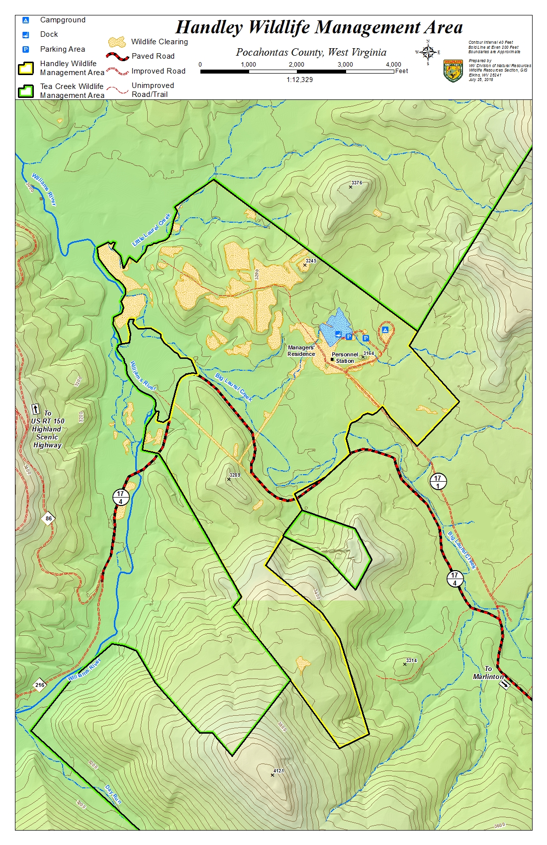
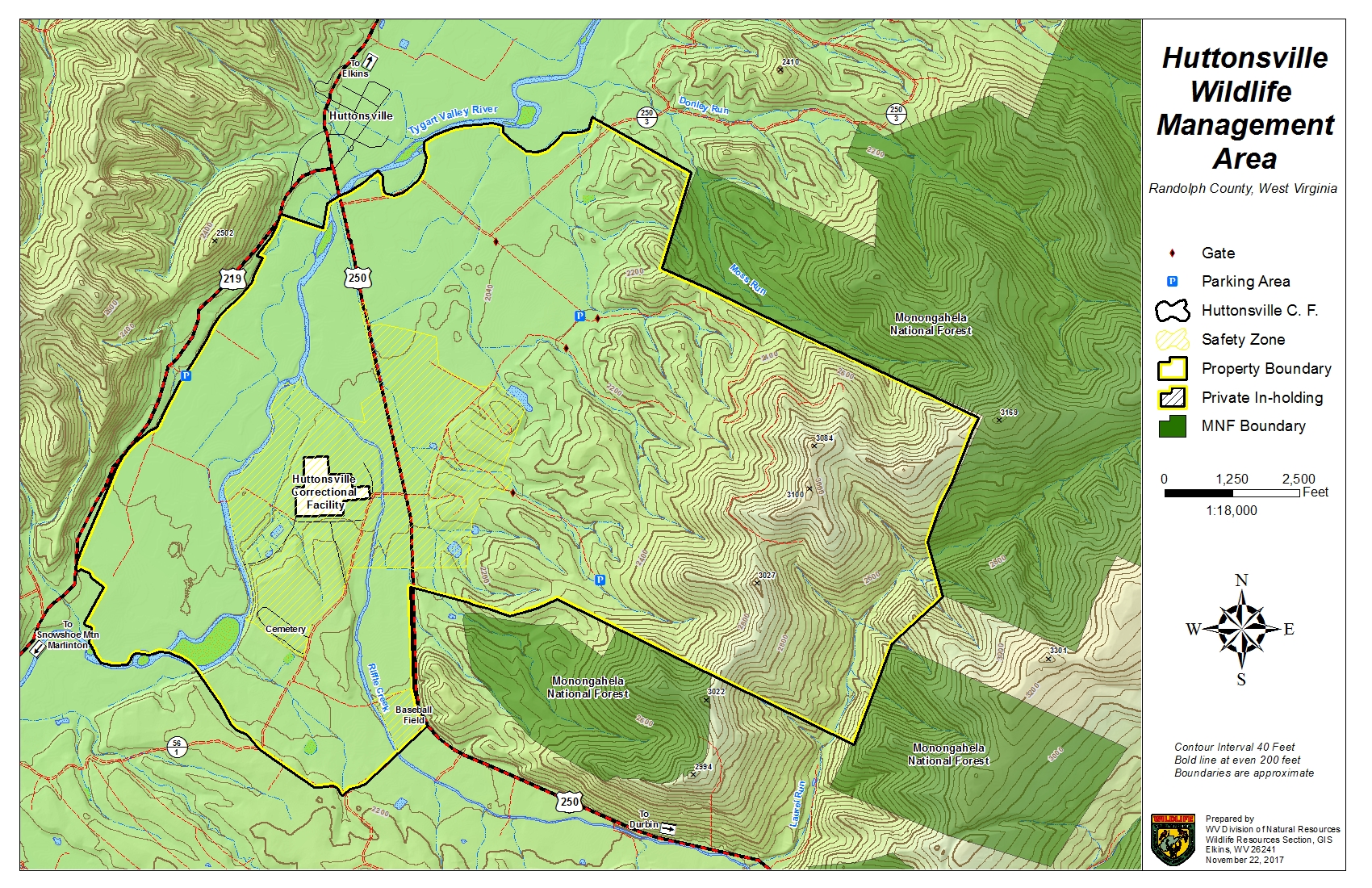
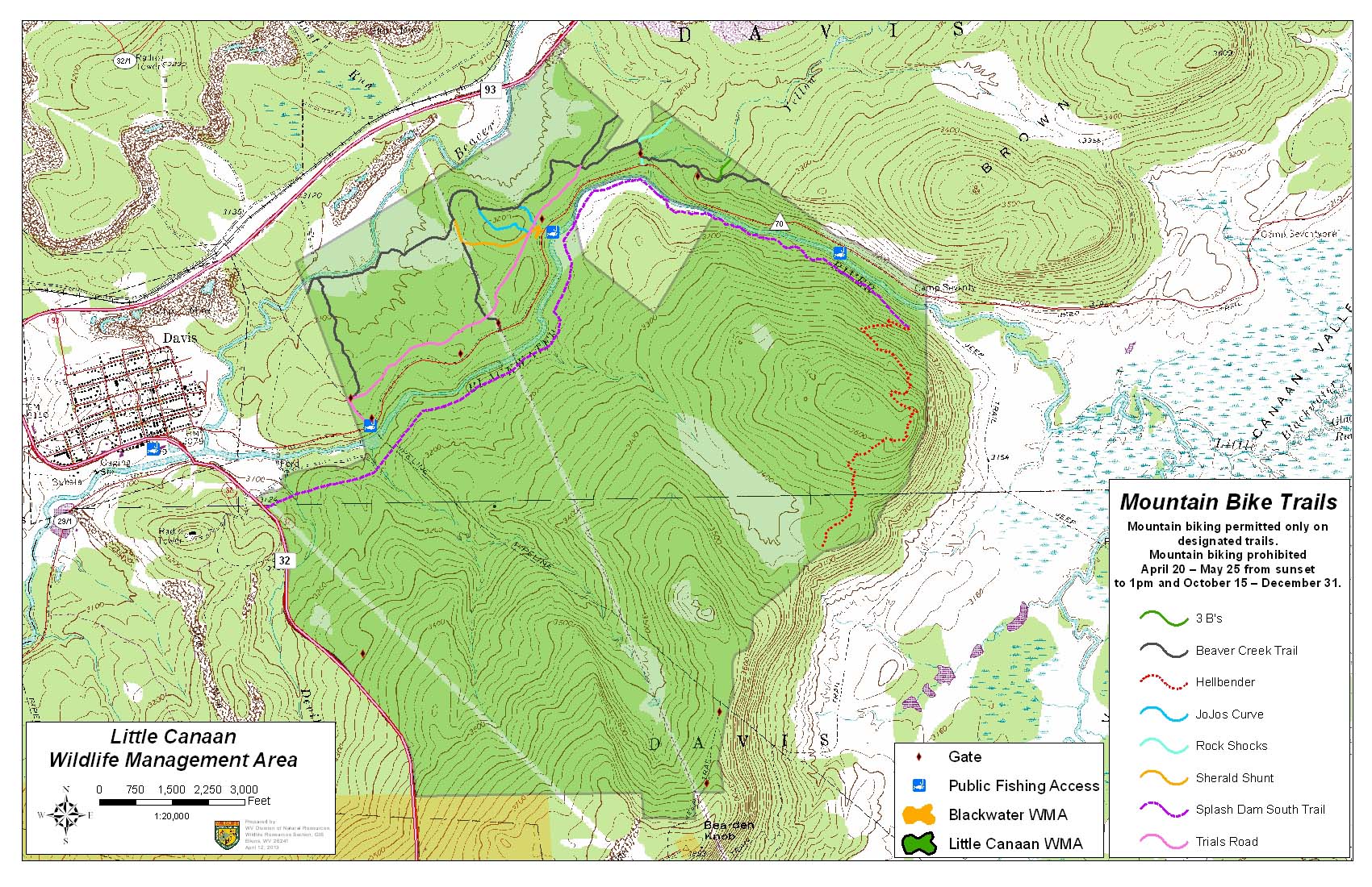
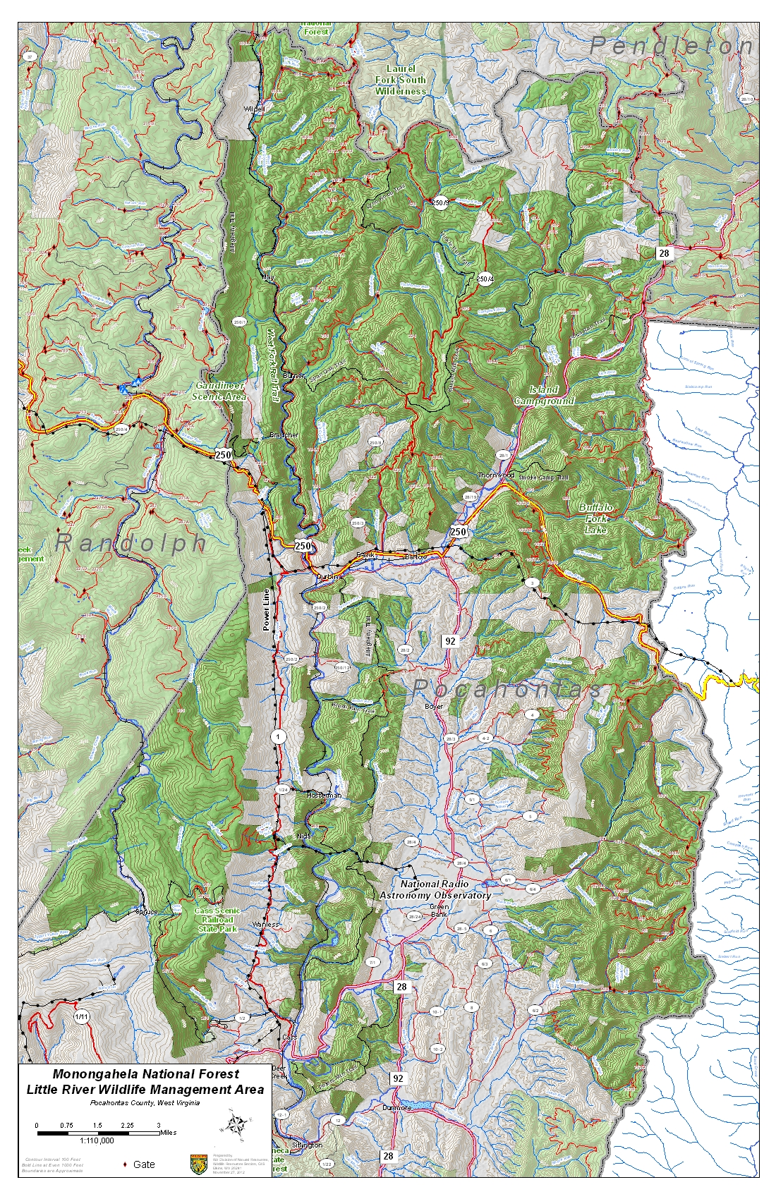
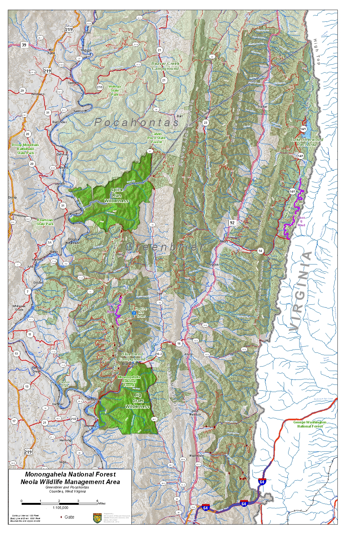
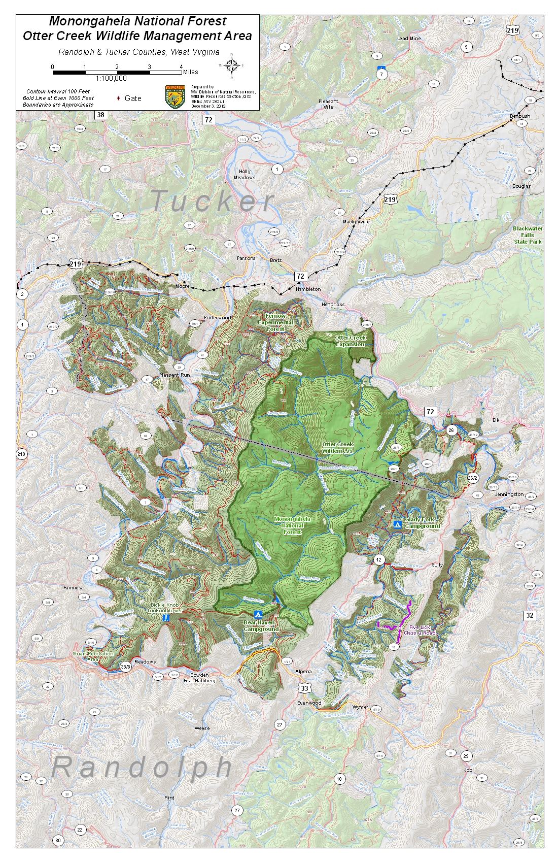
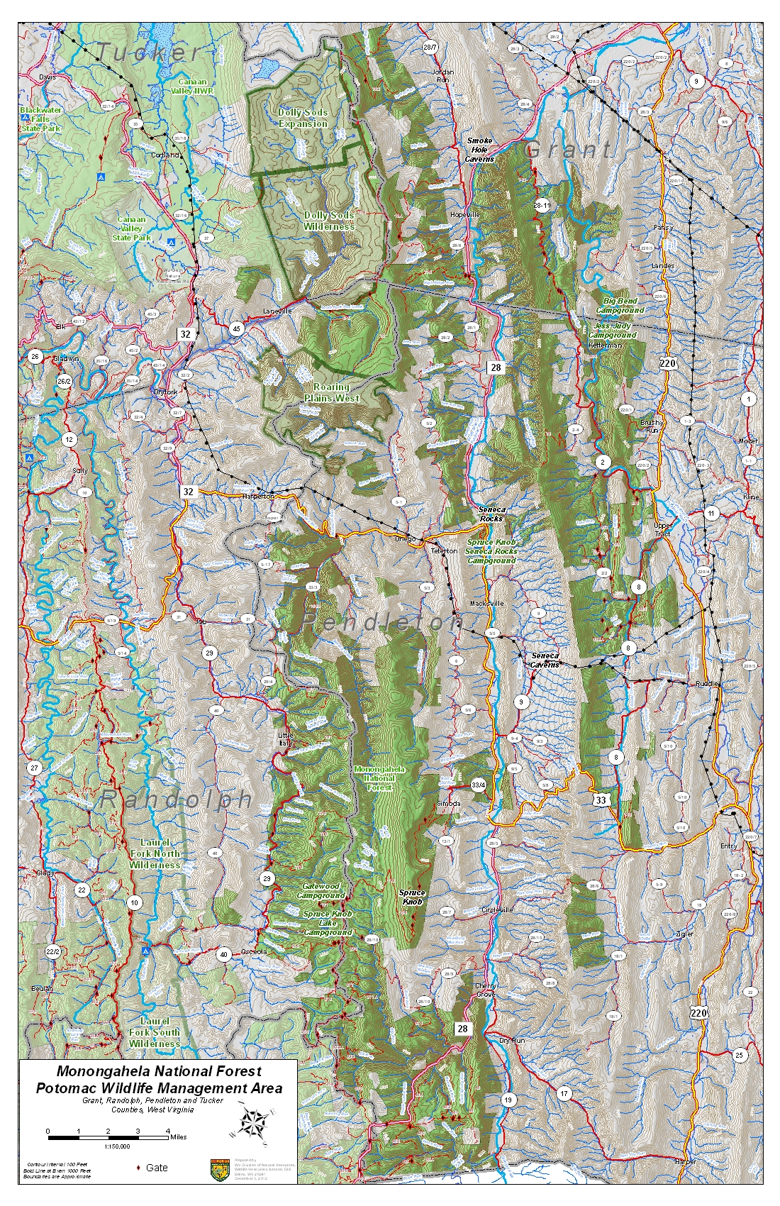
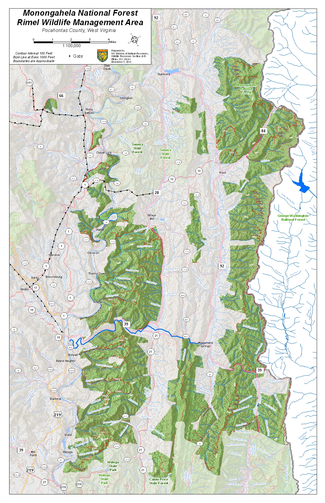
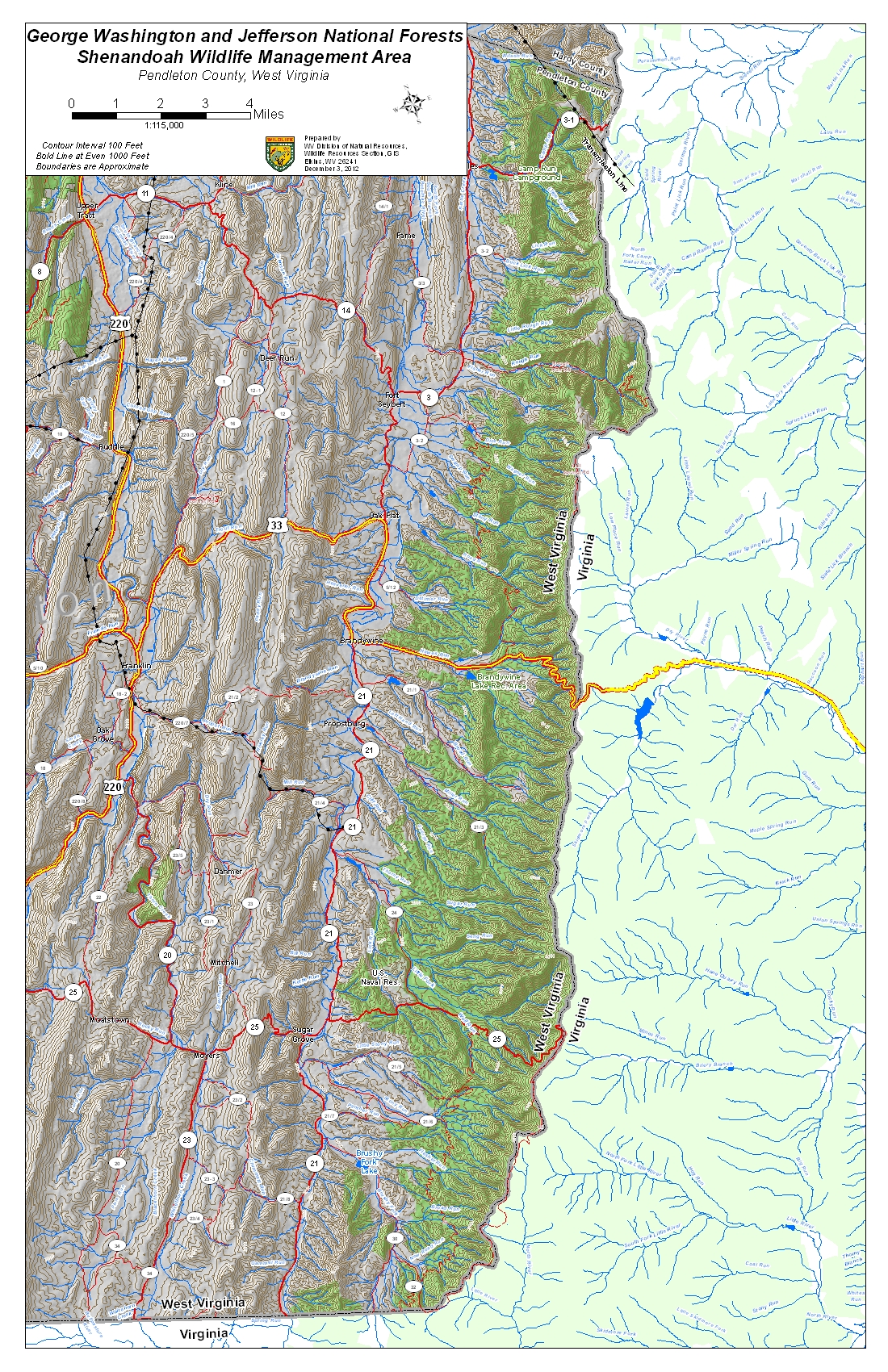
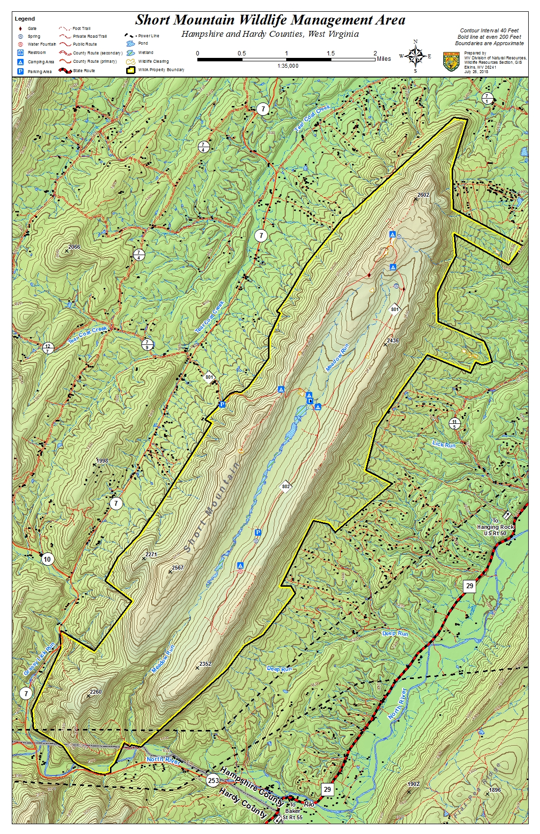
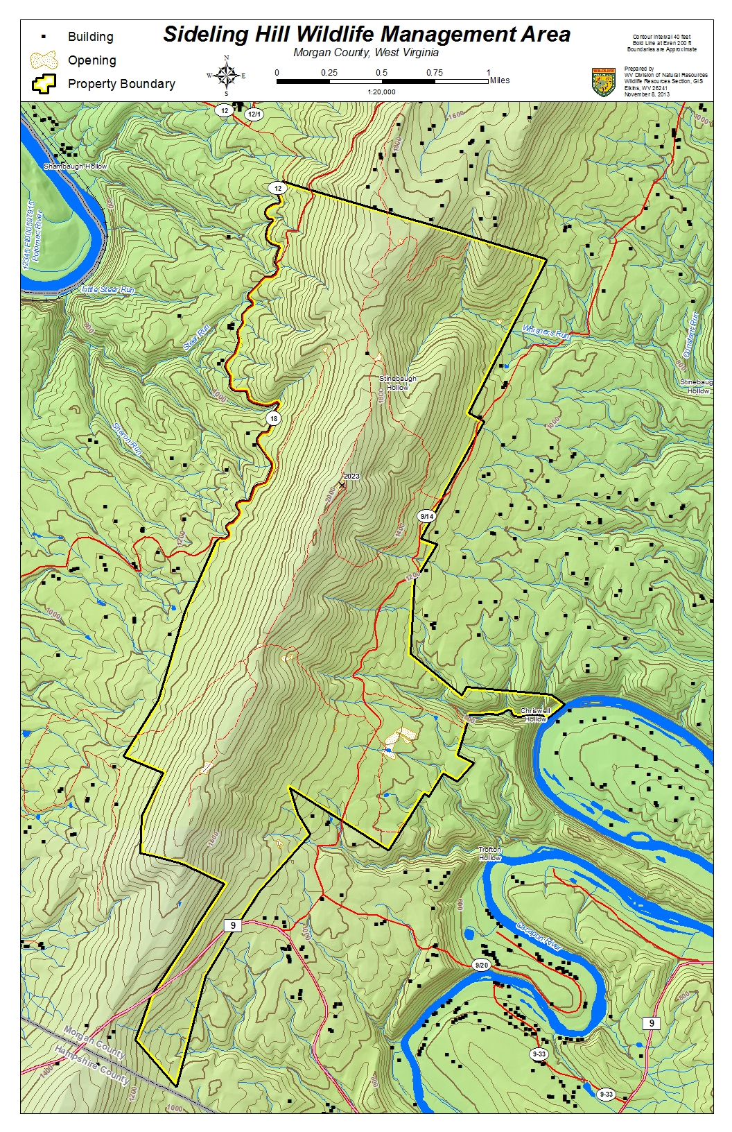
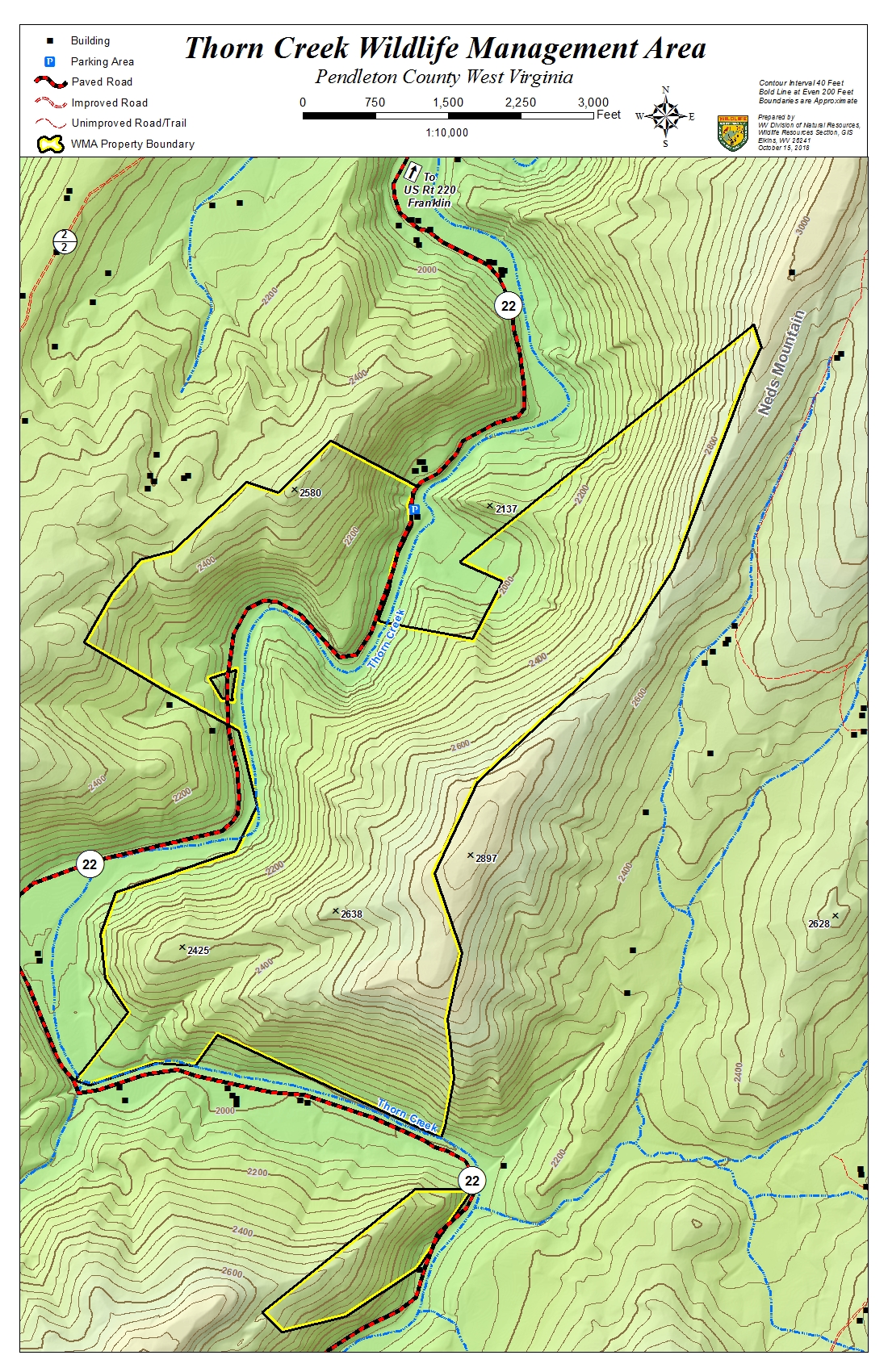
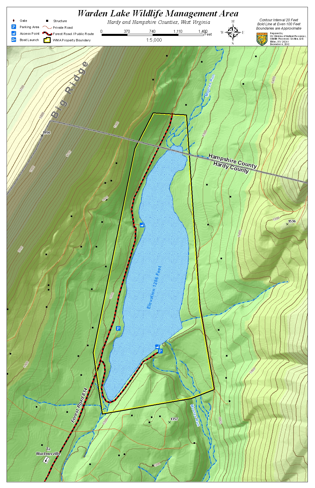
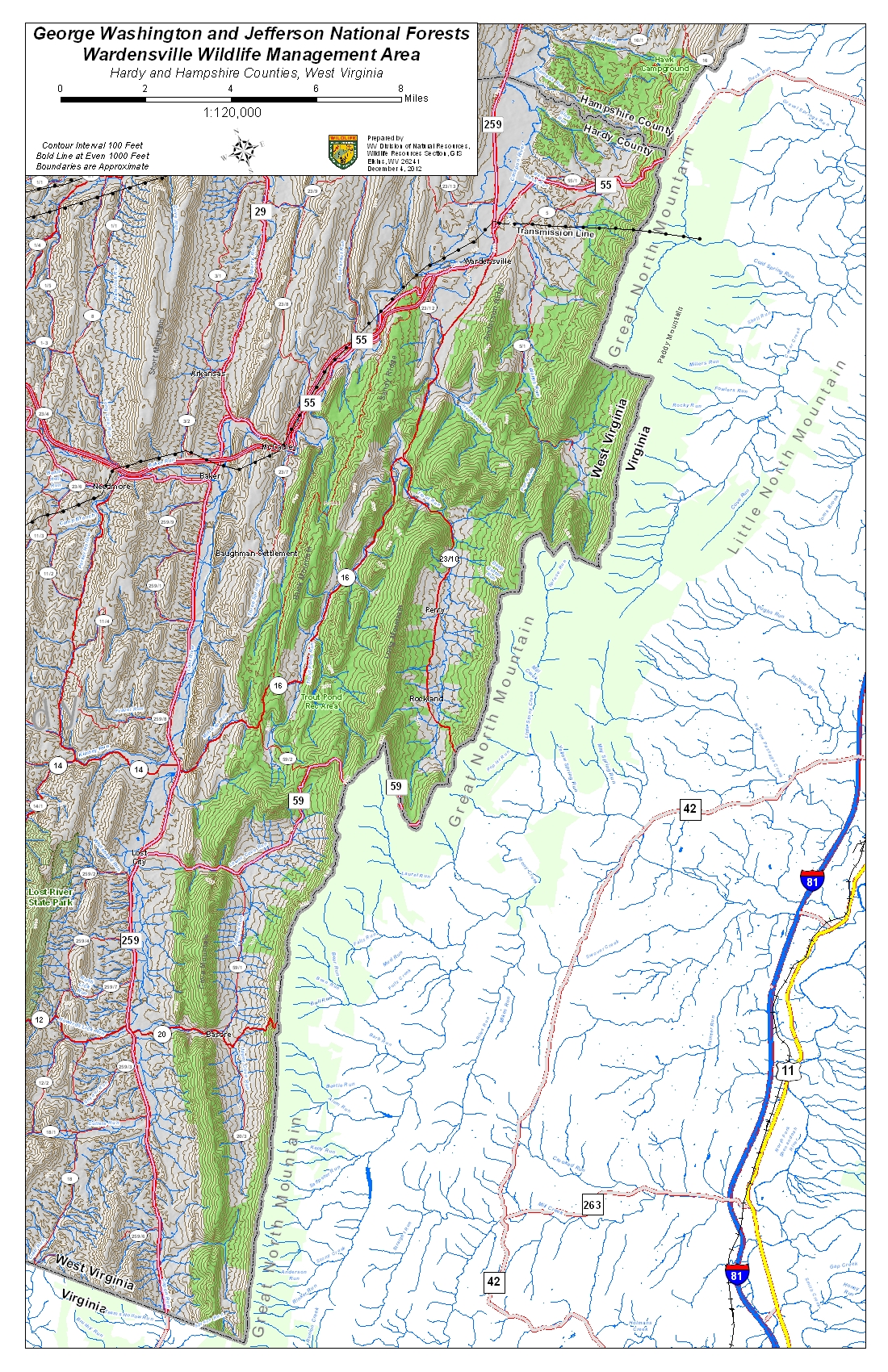
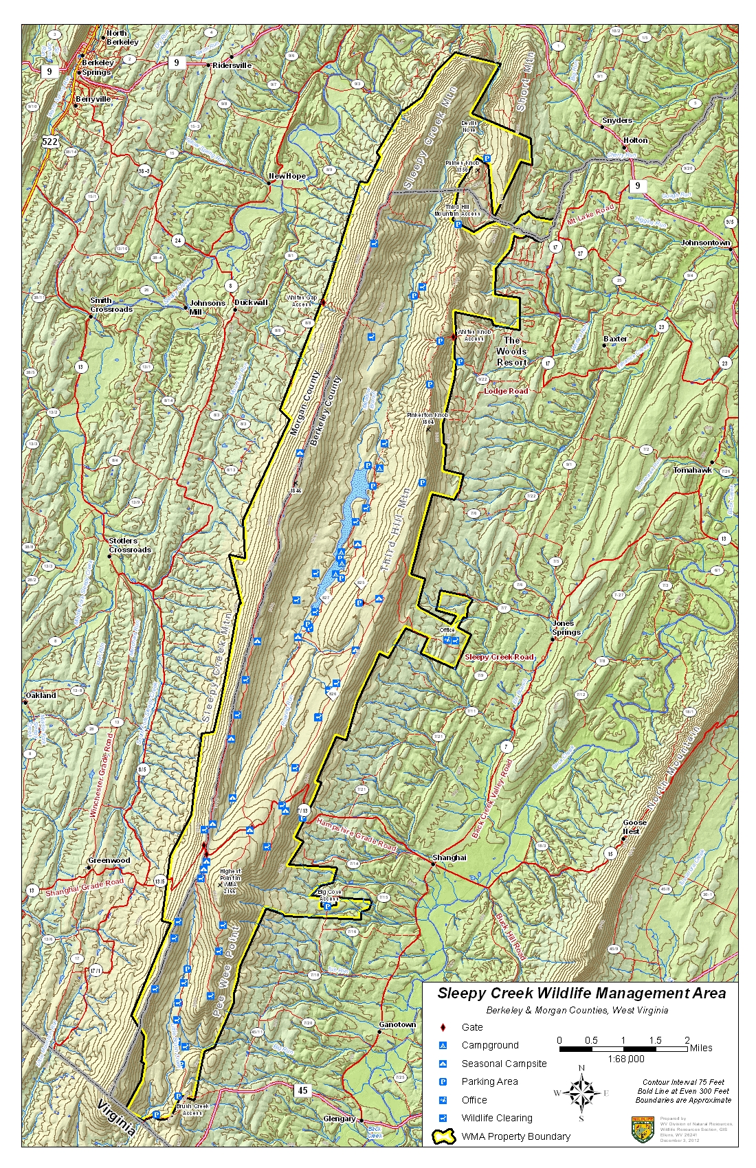
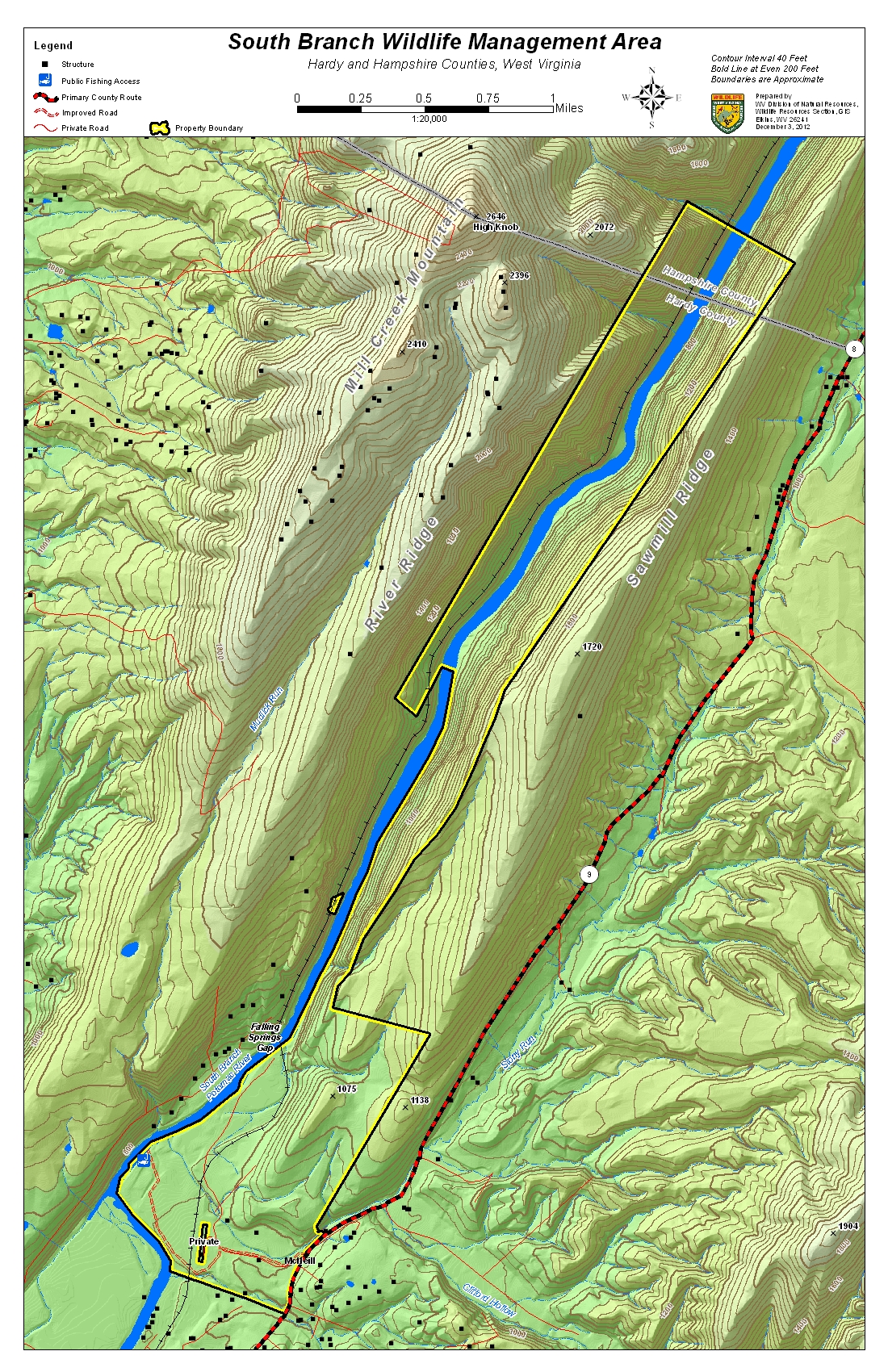
Wildlife Management Areas of the Upper Potomac and nearby West Virginia highlands.

http://southbranchpotomac.blogspot.com/p/south-branch-topo-maps.html

Upper Potomac and other nearby WMA Topo Maps


Provided in a longer statewide list by WVDNR. The file sizes are shown for each map so that the viewer can select which file to download based on their computer equipment and the speed of their internet connection.
WMA NameHigh ResolutionMedium ResolutionLow ResolutionCounty
( 300 dpi PDF)( 150 dpi PDF)( JPEG )
Allegheny WMA Map( 37.7mb )( 10.9mb )( 2.2mb )Mineral


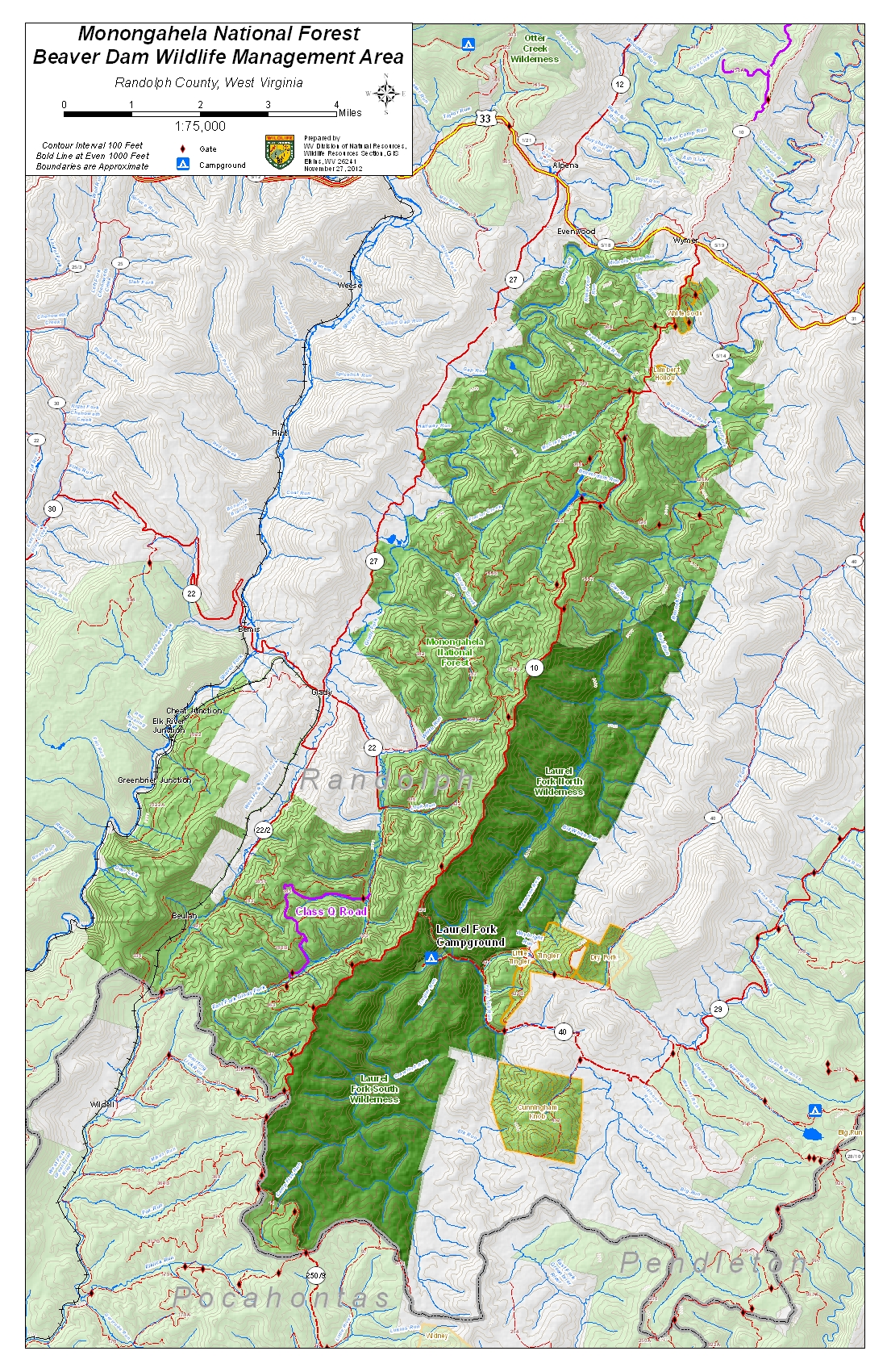
Beaver Dam WMA Map( 16.7mb )( 5.9mb )( 2.2mb )Randolph
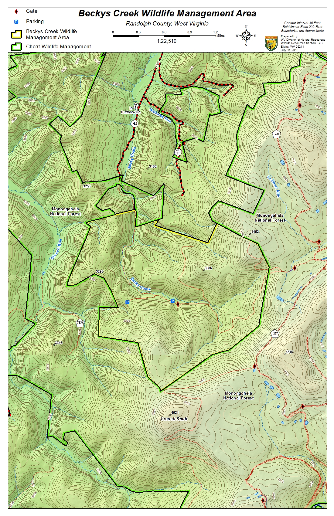
Becky Creek WMA Map( 24.1mb )( 8.2mb )( 2.1mb )Randolph


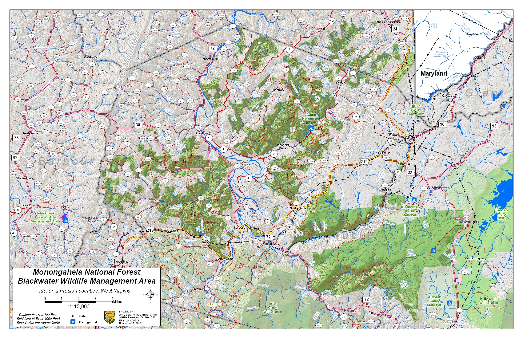
Blackwater WMA Map( 17.1mb )( 6.8mb )( 2.5mb )Tucker & Preston


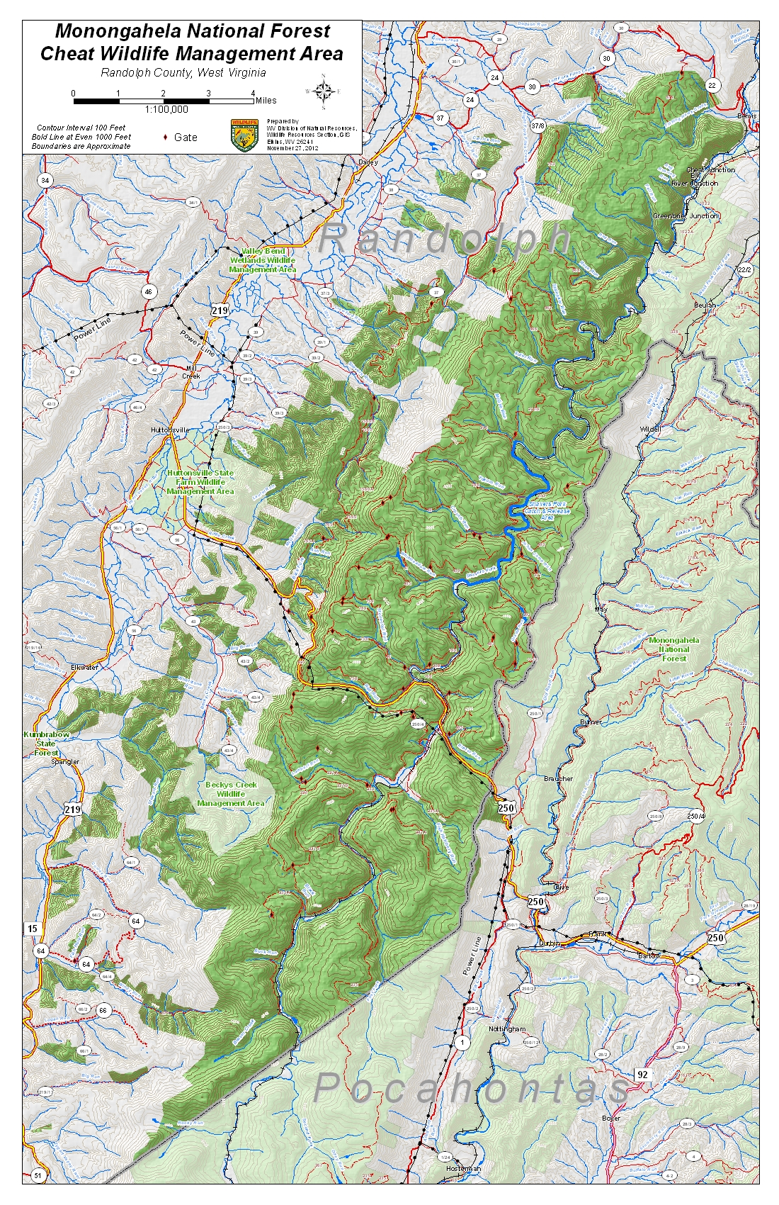
Cheat WMA Map( 17.9mb )( 6.6mb )( 2.4mb )Randolph


Cranberry WMA Map( 27.1mb )( 13.4mb )( 2.7mb )Greenbrier, Pocahontas, 


Edwards Run WMA Map( 17.1mb )( 5.8mb )( 2.0mb )Hampshire


Fort Mill Ridge WMA Map( 10.5mb )( 3.9mb )( 1.5mb )Hampshire
Fox Forest WMA Map(14.5mb )( 4.7mb )( 1.7mb )Randolph


Handley WMA Map( 2.8mb )( 1.8mb )( 1.7mb )Pocahontas


Huttonsville WMA Map( 23.1mb )( 2.0mb )Randolph


Little Canaan WMA Map( 1.7mb )( 0.7mb )( 0.8mb )Tucker & Preston


Little River WMA Map( 26.1mb )( 13.2mb )( 2.5mb )Pocahontas


Nathaniel Mountain WMA Map( 32.6mb )( 10.1mb )( 2.4mb )Hampshire & Hardy
Neola WMA Map( 25.5mb )( 13.9mb )( 2.5mb )Greenbrier & Pocahontas


Otter Creek WMA Map( 16.2mb )( 5.8mb )( 2.2mb )Randolph & Tucker


Potomac WMA Map( 48.3mb )( 33.5mb )( 2.7mb )Grant, Randolph, Pendleton


Rimel WMA Map( 15.6mb )( 5.4mb )( 2.1mb )Pocahontas


Shenandoah WMA Map( 13.8mb )( 5.9mb )( 2.2mb )Pendleton
Short Mountain WMA Map( 31.8mb )( 10.2mb )( 2.4mb )Hampshire & Hardy
Sideling Hill WMA Map( 1.7mb )( 1.0mb )( 1.9mb )Morgan
Slatyfork WMA Map( 14.6mb )( 4.9mb )( 1.8mb )
Sleepy Creek WMA Map( 43.2mb )( 18.7mb )( 2.6mb )Berkeley & Morgan


South Branch WMA Map( 22.1mb )( 7.8mb )( 2.1mb )Hardy & Hampshire


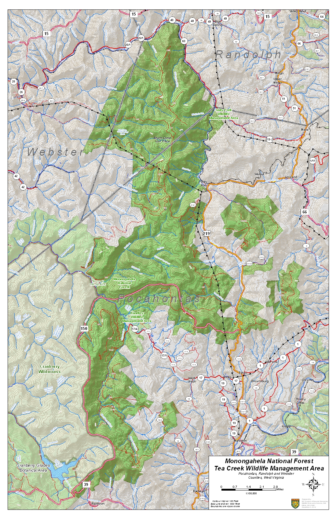
Tea Creek WMA Map( 20.0mb )( 8.5mb )( 2.5mb )Pocahontas, Randolph, & Webster


Thorn Creek WMA Map( 17.0mb )( 5.6mb )( 1.8mb )Pendleton


Warden Lake WMA Map( 9.7mb )( 3.4mb )( 1.6mb )Hardy & Hampshire
Wardensville WMA Map( 11.0mb )( 4.8mb )( 2.2mb )Hardy & Hampshire
Widmeyer WMA Map( 14.6mb )( 4.8mb )( 1.6mb )Morgan

Wednesday, September 14, 2016

Lowest River Levels

This is about as low as the South Branch gets in a typical summer.  Look for trapped minnows and mussels in small channels.  The tadpoles usually do just fine; unfortunately, the insects will also be fine.

South Branch Potomac River near Springfield

Thursday, June 30, 2016

WV Flooding Information

Flooding in West Virginia in June 2016 – Information Sources

by araflo
A line of thunderstorms on June 22-23, 2016, produced between 4 and 12 inches of rain in mountainous parts of eastern West Virginia and western Virginia, leading to devastating and fatal flooding in the Mountain State, as well as flooding in Virginia’s Alleghany Highlands.  A major federal disaster declaration for West Virginia was issued on June 25.  Following are several sources of information on the events.
Kevin Myatt, “Weather Journal” in The Roanoke Times: Train of storms triggered epic W.Va. flooding, Roanoke Times, 6/28/16; and Historic flooding in Alleghany Highlands, 6/24/16.
Charleston [W.Va.] Gazette-Mail, “2016 Flood,” online at http://www.wvgazettemail.com/news/2016floods.
West Virginia Division of Homeland Security and Emergency Management, online athttp://www.dhsem.wv.gov/Pages/default.aspx.
Federal Emergency Management Agency, “West Virginia Severe Storms, Flooding, Landslides, and Mudslides (DR-4273),” online at https://www.fema.gov/disaster/4273.

Friday, June 24, 2016

Flooding limited to lower lattitudes

The North Branch in Cumberland showed almost no response to this week's storms that hit southern West Virginia particularly hard.  However, the North Fork of the South Branch at Petersburg rose by 10-15X in just a few hours or so (although well below the Action Level), and that was largely replicated 14 hours later in Springfield.


Saturday, April 30, 2016

Floodplain Tree Planting

Our West Virginia State conservation agencies and state nurseries partner to provide landowners with trees for habitat, riparian zones, and other advantages.  Here are photos from a tree planting last Friday along the South Branch of the Potomac River near Springfield, WV.


Wednesday, April 27, 2016

Tree Planting - Rain or Shine - April 29 Taylor Farm

Weather may not be perfect on Friday (40%chance of precipitation), but the tree-planting in Springfield is still scheduled rain or shine.  Herb plants trees any time it's not flooding.  ;-)


When:  Friday, April 29, 10am to 2pm.

Location: Clarence Taylor Road off of Springfield Pike east of Springfield, WV.

Directions to the planting site:

From Romney …
Take 28 north to Springfield, WV. Turn right in Springfield onto Road. Travel @2.5 miles to Clarence Taylor Road. Make a left onto a gravel road and travel north to the planting site. Look for signs.

From Slanesville area…
Follow Slanesville Pike west towards the Points intersection. Go straight though the four way stop towards Springfield, WV. After crossing the over the South Branch bridge, take next right onto Clarence Taylor Road. It is 11.7 miles total from Slanesville. Look for signs.