
How Does Climate Change Affect Tick Habitat and the Spread of Lyme Disease in Georgia?
By: Nidhi Gadekar, January 22, 2025
Introduction
As global temperatures rise due to climate change, one of the issues the world faces is the spread of Lyme disease. Lyme disease is a bacterial infection caused by Borrelia burgdorferi and transmitted through the bite of infected black-legged ticks (Ixodes scapularis). It’s the most vector-borne disease in the United States, with approximately 476,000 Americans diagnosed and treated annually, according to the CDC. It is most commonly found in the Northeast, mid-Atlantic, and Upper Midwest regions in the U.S., but Lyme disease is even greater in central and eastern European countries.
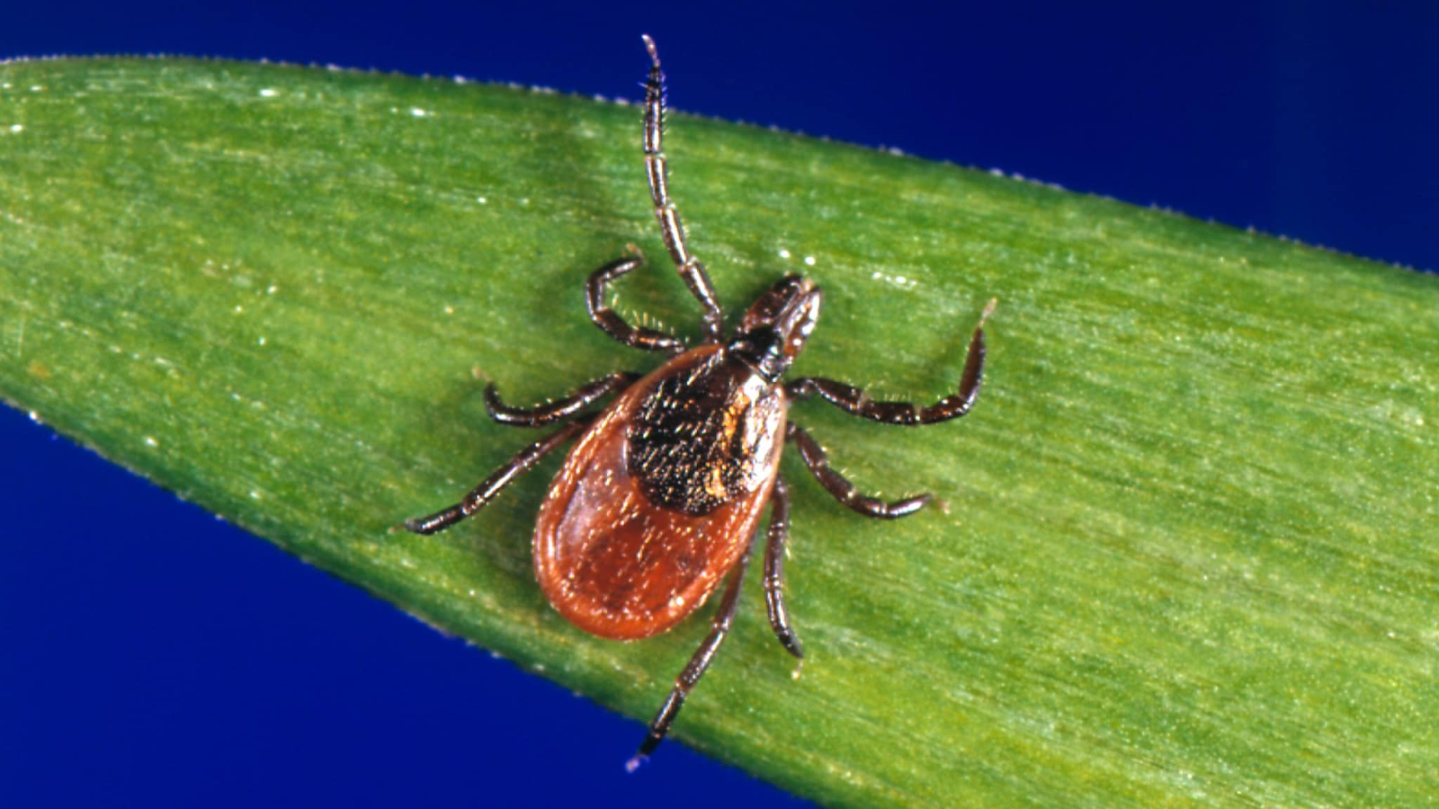
(Source: Blacklegged Tick Surveillance)
While Lyme disease is traditionally common in cooler regions like the Northeastern U.S., it is becoming a growing concern for Southern States such as Georgia. This is particularly alarming because Lyme disease can cause debilitating long-term complications if not treated early. Understanding how climate change influences the spread of Lyme disease in traditionally warmer climates is essential for public health preparedness and prevention. In this post, we’re advocating for the exploration of how climate change is expanding tick habitats, tick prevalence, and population density, in Georgia and the role of Geographic Information Systems (GIS) in understanding and managing the potential for increased Lyme disease risk.
Overview of Lyme disease
Lyme disease can be characterized by two stages:
In the early stage (3-30 days post-bite), the patient has symptoms such as fever, chills, headaches, fatigue, and an erythema migrans rash, which has a bull's-eye appearance.
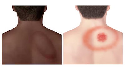
(Source: Clinical Treatment of Erythema Migrans Rash)
In the later stage (30 days or more post-bite), the patient has symptoms such as severe headaches, facial palsy, arthritis, heart palpitations, nerve pain, and inflammation of the brain or spinal cord.
Due to the severe symptoms of the later stage, it’s essential to receive antibiotic treatment to prevent long-term complications. However, some patients experience Post-Treatment Lyme Disease Syndrome, which consists of lingering symptoms such as fatigue and cognitive difficulties even after receiving antibiotic treatment.
Climate Change and Expanding Tick Habitats
In Georgia, warmer temperatures and milder winters are allowing black-legged ticks to survive in greater numbers and for longer periods. The black-legged ticks, which typically spread Lyme disease, thrive in dense forests, woodland edges, tall grasses, and humid environments. These habitats provide the moisture, shelter, and proximity to hosts like deer and small habitats that ticks require. This tick species is known to be active in Georgia any time temperatures are above freezing.
Climate change alters and expands these habitats, allowing ticks to survive in regions that were previously unsuitable for them. Despite Lyme disease typically being more common in cooler regions like the Northeast and upper Midwest, rising temperatures make Georgia more suitable for black-legged ticks. For example, harsh winters typically kill off ticks. But these milder winters have allowed more ticks to survive year-round, leading to larger populations. It’s also led to warmer springs and autumns, extending the period in which ticks can find hosts. In addition, climate change has also brought more frequent rainfall and higher humidity, which is beneficial to ticks.
Hahn et. al (2022) analyzed 18 years of Lyme disease case data across the U.S. and found the climate to be a significant predictor of disease incidence. Bellmasn et. al (2024) mainly focused on mapping tick distributions in Georgia specifically. The study highlighted how climate change extends the active period of ticks and allows black-legged ticks to expand their range. Eisen and Eisen (2024) studied the history of I. scapularis expansion and revealed that southward expansion of northern populations, for which the host questing (hunting/waiting) behavior of the nymphal stage leads to a substantially higher risk of human bites compared with southern populations, into Virginia and North Carolina also was followed by rising numbers of Lyme disease cases.
(Source: PBS, Why Lyme and other tick-borne diseases are on the rise)
GIS Applications in Lyme Disease Research
Geographic Information Systems (GIS) are important tools used to analyze spatial and environmental data. By applying GIS to Lyme disease research, scientists can:
Map tick species distributions across Georgia;
Identify high-risk areas by correlating tick species populations with environmental factors like vegetation, soil moisture, and elevation; and
Build predictive models to assess Lyme disease risk under various climate scenarios.
These insights can help guide public health interventions such as targeted tick control measures or community education campaigns in high-risk areas.
Conclusion
Climate change is changing the incidence of cases of infectious diseases, with Lyme disease starting to become a concern in Georgia. As tick habitats expand due to climate change, it’s important to explore this topic and create preventative strategies. By leveraging tools such as GIS, we can better understand and mitigate the impact of climate change on Lyme disease.
Works Cited:
Bellman, S., Fausett, E., Aeschleman, L. et al. (2024). Mapping the distribution of Amblyomma americanum in Georgia, USA. Parasites Vectors 17, 62 (2024). https://doi.org/10.1186/s13071-024-06142-7
Eisen and Eisen (2024) “Changes in the geographic distribution of the black-legged tick, Ixodes scapularis, in the United States.
Hahn et al. (2022) "Impact of prior and projected climate change on US Lyme disease incidence"
About the Author:
Nidhi Gadekar (she/her) is a high school senior at Innovation Academy in Georgia who’s an aspiring pre-med student passionate about public health and epidemiology. Connect with her on Linkedin.
No comments:
Post a Comment